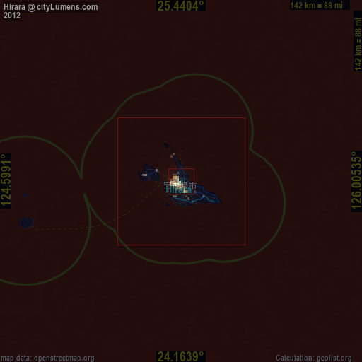
Hirara night lights from space
Night Light of Hirara (Okinawa) from space (Japan) Src. Average luminocity for 10x10km area is 13.3504% and for 50x50km: 0.7279%.
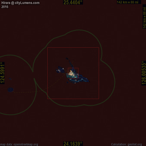
Analysis of Hirara night lights 2016
Square area 10x10 km:
 0%
0%90-99
0%80-89
0%70-79
4.36%60-69
3.6%50-59
3.79%40-49
3.03%30-39
3.22%20-29
2.46%10-19
1.89%0-9
77.65%Square area 50x50 km:
0%90-99
0%80-89
0%70-79
0.18%60-69
0.15%50-59
0.19%40-49
0.18%30-39
0.23%20-29
0.26%10-19
0.19%0-9
98.63%Clear (daylight) street map image can be seen on geolist.org.
Map coordinates:
25° 26' 25.4" North, 124° 35' 56.8" East
24° 48' 13.6" North, 125° 18' 8" East
24° 9' 50" North, 126° 0' 19.3" East
Some cities around Hirara sort by population:
• Naha
285.9 km =177.7 mi,  56°
56°
• Okinawa
303.1 km =188.3 mi, 55°
• Ginowan
295.3 km =183.5 mi, 56°
• Itoman
279.4 km =173.6 mi, 58°
• Tomigusuku
284 km =176.5 mi, 57°
• Ishigaki
126.5 km =78.6 mi,  246°
246°
• Katsuren-haebaru
308.9 km =191.9 mi, 56°
• Chatan
298.8 km =185.7 mi, 55°
1862505 (p: 34,354)
Sources (retrieved 2019-11-25):
» Earth at Night: Flat Maps 2012, 2016