Katsuren-haebaru night lights from space
Night Light of Katsuren-haebaru (Okinawa) from space (Japan) Src. Average luminocity for 10x10km area is 47.4327% and for 50x50km: 20.6322%.
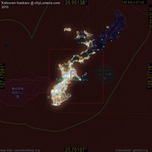

Analysis of Katsuren-haebaru night lights 2016
Square area 10x10 km:
 9.45%
9.45%90-99
8.73%80-89
4%70-79
8.91%60-69
8.36%50-59
7.45%40-49
3.27%30-39
4%20-29
14.91%10-19
21.27%0-9
9.64%Square area 50x50 km:
4.04%90-99
3.9%80-89
1.65%70-79
2.85%60-69
3.79%50-59
3.27%40-49
1.84%30-39
2.91%20-29
4.81%10-19
10.13%0-9
60.82%Clear (daylight) street map image can be seen on geolist.org.
Map coordinates:
26° 57' 41" North, 127° 10' 15.3" East
26° 19' 58.6" North, 127° 52' 26.5" East
25° 42' 3.9" North, 128° 34' 37.8" East
Some cities around Katsuren-haebaru sort by population:
• Naha
23 km =14.3 mi,  235°
235°
• Okinawa
7.2 km =4.5 mi,  272°
272°
• Ginowan
13.7 km =8.5 mi, 235°
• Gushikawa
3 km =1.9 mi,  347°
347°
• Itoman
30.7 km =19.1 mi,  221°
221°
• Tomigusuku
25.2 km =15.7 mi,  229°
229°
• Chatan
10.7 km =6.6 mi,  255°
255°
• Ishikawa
11.3 km =7 mi,  332°
332°
1863426 (p: 34,239)
Sources (retrieved 2019-11-25):
» Earth at Night: Flat Maps 2012, 2016