Okinawa night lights from space
Night Light of Okinawa from space (Japan) Src. Average luminocity for 10x10km area is 84.8371% and for 50x50km: 20.8686%.
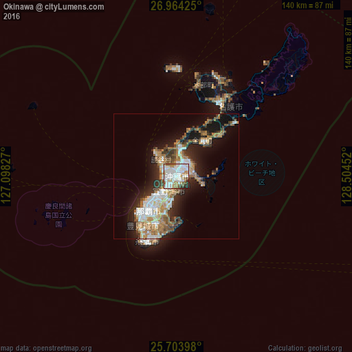

Analysis of Okinawa night lights 2016
Square area 10x10 km:
 31.63%
90-99
32.95%80-89
4.55%70-79
6.44%60-69
9.85%50-59
6.25%40-49
2.27%30-39
1.7%20-29
3.98%10-19
0.38%0-9
0%Square area 50x50 km:
4.07%90-99
3.93%80-89
1.67%70-79
2.87%60-69
3.79%50-59
3.29%40-49
1.86%30-39
2.9%20-29
4.85%10-19
10.56%0-9
60.21%Clear (daylight) street map image can be seen on geolist.org.
Map coordinates:
26° 57' 51.3" North, 127° 5' 53.8" East
26° 20' 9" North, 127° 48' 5" East
25° 42' 14.3" North, 128° 30' 16.3" East
Some cities around Okinawa sort by population:
• Naha
17.7 km =11 mi,  221°
221°
• Ginowan
9.1 km =5.7 mi,  206°
206°
• Gushikawa
7.1 km =4.4 mi,  68°
68°
• Itoman
26.8 km =16.7 mi, 209°
• Tomigusuku
20.5 km =12.7 mi, 215°
• Katsuren-haebaru
7.2 km =4.5 mi,  92°
92°
• Chatan
4.3 km =2.7 mi,  226°
226°
• Ishikawa
9.9 km =6.2 mi,  11°
11°
1894616 (p: 125,483)
Sources (retrieved 2019-11-25):
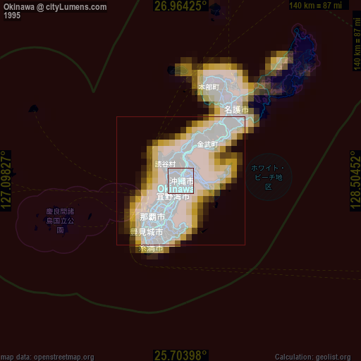
» NASA, Earths city lights 1995
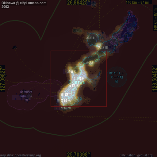
» NASA city lights 2003
» Earth at Night: Flat Maps 2012, 2016