Hakui night lights from space
Night Light of Hakui (Ishikawa) from space (Japan) Src. Average luminocity for 10x10km area is 9.4968% and for 50x50km: 7.2712%.
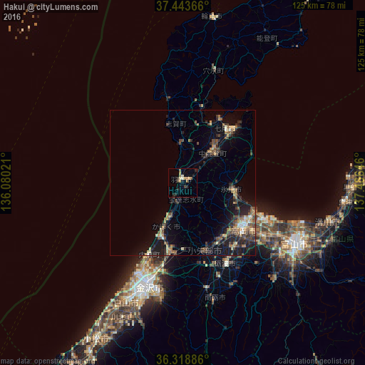
Analysis of Hakui night lights 2016
Square area 10x10 km:
 0%
0%90-99
1.3%80-89
0.65%70-79
2.44%60-69
1.62%50-59
1.79%40-49
0.49%30-39
1.79%20-29
4.22%10-19
0.65%0-9
85.06%Square area 50x50 km:
0.25%90-99
0.59%80-89
0.78%70-79
0.96%60-69
1.14%50-59
1.02%40-49
1.93%30-39
1.57%20-29
2.69%10-19
5.9%0-9
83.18%Clear (daylight) street map image can be seen on geolist.org.
Map coordinates:
37° 26' 37.2" North, 136° 4' 48.8" East
36° 52' 60" North, 136° 46' 60" East
36° 19' 7.9" North, 137° 29' 11.3" East
Some cities around Hakui sort by population:
• Kanazawa
34.8 km =21.6 mi,  205°
205°
• Takaoka
25.5 km =15.8 mi,  125°
125°
• Nanto-shi
36.7 km =22.8 mi,  161°
161°
• Himimachi
18.5 km =11.5 mi,  99°
99°
• Nanao
24.7 km =15.3 mi,  41°
41°
• Tsubata
24 km =14.9 mi,  189°
189°
• Nishishinminato
28.5 km =17.7 mi,  113°
113°
• Fukumitsu
37 km =23 mi,  168°
168°
1863341 (p: 24,529)
Sources (retrieved 2019-11-25):
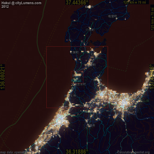
» Earth at Night: Flat Maps 2012, 2016