Hakone night lights from space
Night Light of Hakone (Kanagawa) from space (Japan) Src. Average luminocity for 10x10km area is 6.3444% and for 50x50km: 17.1974%.
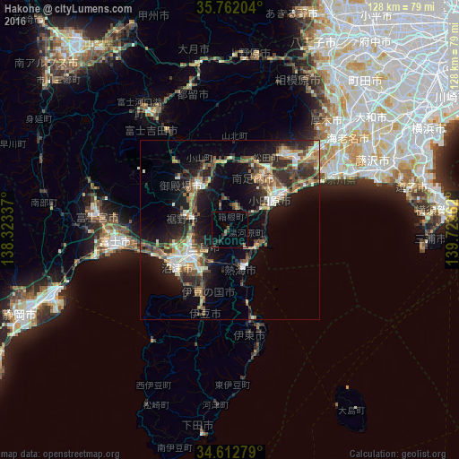
Analysis of Hakone night lights 2016
Square area 10x10 km:
 0.17%
0.17%90-99
0.35%80-89
0%70-79
0.7%60-69
0.17%50-59
1.57%40-49
0.35%30-39
2.27%20-29
3.85%10-19
0.35%0-9
90.21%Square area 50x50 km:
1.66%90-99
2.56%80-89
1.65%70-79
2.29%60-69
2.15%50-59
2.61%40-49
3.66%30-39
3.38%20-29
5.79%10-19
11.85%0-9
62.39%Clear (daylight) street map image can be seen on geolist.org.
Map coordinates:
35° 45' 43.3" North, 138° 19' 24.1" East
35° 11' 22" North, 139° 1' 35.4" East
34° 36' 46" North, 139° 43' 46.6" East
Some cities around Hakone sort by population:
• Numazu
17.6 km =10.9 mi,  235°
235°
• Odawara
14.2 km =8.8 mi,  58°
58°
• Mishima
12.9 km =8 mi,  230°
230°
• Gotenba
16.2 km =10.1 mi,  332°
332°
• Itō
25.3 km =15.7 mi,  168°
168°
• Atami
11.5 km =7.1 mi, 167°
• Ninomiya
24.3 km =15.1 mi, 59°
• Yugawara
5.7 km =3.5 mi,  140°
140°
1863357 (p: 13,339)
Sources (retrieved 2019-11-25):
» Earth at Night: Flat Maps 2012, 2016