Al Mazār al Janūbī night lights from space
Night Light of Al Mazār al Janūbī (Karak) from space (Jordan) Src. Average luminocity for 10x10km area is 32.7967% and for 50x50km: 9.318%.
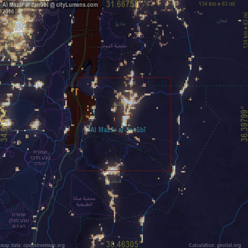
Analysis of Al Mazār al Janūbī night lights 2016
Square area 10x10 km:
 5.13%
5.13%90-99
4.76%80-89
5.49%70-79
4.76%60-69
1.28%50-59
4.21%40-49
3.48%30-39
3.48%20-29
11.17%10-19
39.93%0-9
16.3%Square area 50x50 km:
0.76%90-99
0.99%80-89
0.94%70-79
1.91%60-69
0.85%50-59
0.99%40-49
2.06%30-39
1.59%20-29
3.04%10-19
7.15%0-9
79.69%Clear (daylight) street map image can be seen on geolist.org.
Map coordinates:
31° 40' 3.3" North, 34° 59' 30.3" East
31° 4' 2" North, 35° 41' 41.5" East
30° 27' 47" North, 36° 23' 52.8" East
Some cities around Al Mazār al Janūbī sort by population:
• Aţ Ţafīlah
27 km =16.8 mi,  198°
198°
• ‘Izrā
10.2 km =6.3 mi,  358°
358°
• Qīr Moāv
12.8 km =8 mi,  2°
2°
• Karak City
12.5 km =7.8 mi,  30°
30°
• Safi
22.1 km =13.7 mi,  260°
260°
• ‘Ayy
8.9 km =5.5 mi,  326°
326°
• Buşayrā
38.1 km =23.7 mi,  192°
192°
• Al Khinzīrah
8.7 km =5.4 mi, 257°
250540 (p: 9,383)
Sources (retrieved 2019-11-25):
» Earth at Night: Flat Maps 2012, 2016