Zogno night lights from space
Night Light of Zogno (Lombardy) from space (Italy) Src. Average luminocity for 10x10km area is 25.4375% and for 50x50km: 38.6166%.
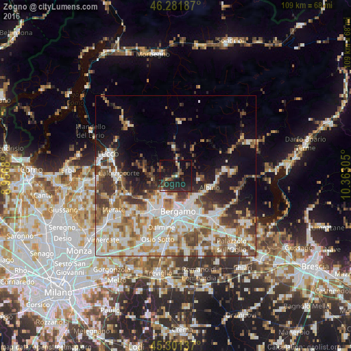
Analysis of Zogno night lights 2016
Square area 10x10 km:
 1.19%
1.19%90-99
0.89%80-89
1.04%70-79
2.23%60-69
4.61%50-59
4.61%40-49
3.13%30-39
6.7%20-29
23.21%10-19
39.43%0-9
12.95%Square area 50x50 km:
8.73%90-99
9.32%80-89
3.7%70-79
4.36%60-69
5.61%50-59
5.4%40-49
5.29%30-39
5.82%20-29
5.25%10-19
10.18%0-9
36.32%Clear (daylight) street map image can be seen on geolist.org.
Map coordinates:
46° 16' 54.7" North, 8° 57' 24.5" East
45° 47' 37.6" North, 9° 39' 35.7" East
45° 18' 4.9" North, 10° 21' 47" East
Some cities around Zogno sort by population:
• Alzano Lombardo
8.2 km =5.1 mi,  140°
140°
• Sorisole
7.2 km =4.5 mi,  194°
194°
• Torre Boldone
9.3 km =5.8 mi,  156°
156°
• Ponteranica
6.8 km =4.2 mi, 185°
• Villa d'Almè
6 km =3.7 mi,  213°
213°
• Ranica
8.9 km =5.5 mi,  152°
152°
• Almenno San Salvatore
6.9 km =4.3 mi,  224°
224°
• Almè
7 km =4.3 mi, 209°
3163854 (p: 5,694)
Sources (retrieved 2019-11-25):
» Earth at Night: Flat Maps 2012, 2016