Vigodarzere night lights from space
Night Light of Vigodarzere (Veneto) from space (Italy) Src. Average luminocity for 10x10km area is 83.6286% and for 50x50km: 51.147%.
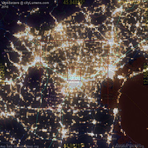
Analysis of Vigodarzere night lights 2016
Square area 10x10 km:
 26.83%
90-99
24.76%80-89
10.32%70-79
11.59%60-69
13.49%50-59
8.57%40-49
3.33%30-39
1.11%20-29
0%10-19
0%0-9
0%Square area 50x50 km:
7.22%90-99
9.73%80-89
4.95%70-79
6.57%60-69
8.7%50-59
11.41%40-49
11.53%30-39
10.09%20-29
13.66%10-19
10.34%0-9
5.79%Clear (daylight) street map image can be seen on geolist.org.
Map coordinates:
45° 56' 54.8" North, 11° 10' 56.7" East
45° 27' 27" North, 11° 53' 8" East
44° 57' 43.7" North, 12° 35' 19.2" East
Some cities around Vigodarzere sort by population:
• Padova
5.5 km =3.4 mi,  179°
179°
• Vigonza
7.4 km =4.6 mi,  109°
109°
• Campodarsego
5.3 km =3.3 mi,  32°
32°
• Mejaniga
1.6 km =1 mi,  89°
89°
• Noventa
7 km =4.3 mi,  133°
133°
• Sarmeola
6.5 km =4 mi,  235°
235°
• Caselle
7.4 km =4.6 mi,  226°
226°
• Limena
3.4 km =2.1 mi,  293°
293°
3164332 (p: 6,278)
Sources (retrieved 2019-11-25):
» Earth at Night: Flat Maps 2012, 2016