Vergiate night lights from space
Night Light of Vergiate (Lombardy) from space (Italy) Src. Average luminocity for 10x10km area is 39.5197% and for 50x50km: 42.1955%.
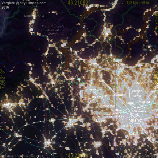
Analysis of Vergiate night lights 2016
Square area 10x10 km:
 3.33%
3.33%90-99
4.85%80-89
3.33%70-79
3.79%60-69
4.85%50-59
6.97%40-49
11.36%30-39
10.91%20-29
28.03%10-19
22.58%0-9
0%Square area 50x50 km:
6.75%90-99
8.58%80-89
4.09%70-79
5.2%60-69
6.92%50-59
6.85%40-49
6.72%30-39
6.9%20-29
9.64%10-19
22.18%0-9
16.17%Clear (daylight) street map image can be seen on geolist.org.
Map coordinates:
46° 12' 39" North, 7° 59' 31.8" East
45° 43' 19.6" North, 8° 41' 43.1" East
45° 13' 44.6" North, 9° 23' 54.3" East
Some cities around Vergiate sort by population:
• Somma Lombardo
4.5 km =2.8 mi,  167°
167°
• Castelletto Sopra Ticino
4.8 km =3 mi,  267°
267°
• Sesto Calende
4.8 km =3 mi,  275°
275°
• Casorate Sempione
6.9 km =4.3 mi,  145°
145°
• Sumirago
7 km =4.3 mi,  76°
76°
• Cavaria Con Premezzo
9 km =5.6 mi,  111°
111°
• Besnate
6.2 km =3.9 mi,  115°
115°
• Albizzate
8.4 km =5.2 mi,  86°
86°
3164548 (p: 5,814)
Sources (retrieved 2019-11-25):
» Earth at Night: Flat Maps 2012, 2016