Sumirago night lights from space
Night Light of Sumirago (Lombardy) from space (Italy) Src. Average luminocity for 10x10km area is 58.5485% and for 50x50km: 47.9554%.
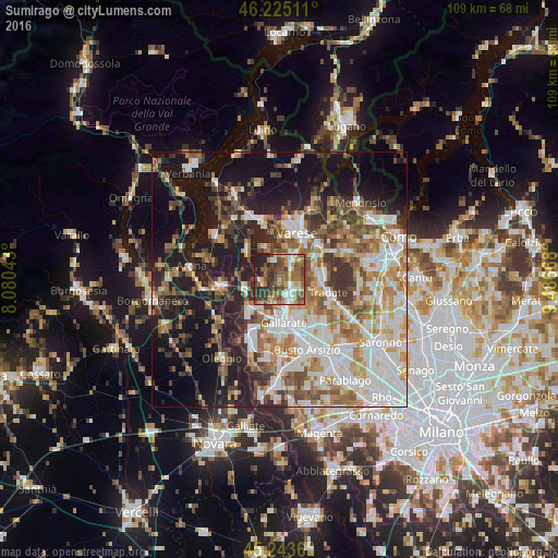
Analysis of Sumirago night lights 2016
Square area 10x10 km:
 7.27%
7.27%90-99
8.64%80-89
7.12%70-79
6.36%60-69
15.91%50-59
16.21%40-49
13.33%30-39
12.27%20-29
11.97%10-19
0.91%0-9
0%Square area 50x50 km:
9.78%90-99
11.13%80-89
4.7%70-79
5.94%60-69
7.19%50-59
6.85%40-49
6.31%30-39
6.79%20-29
8.85%10-19
19.39%0-9
13.08%Clear (daylight) street map image can be seen on geolist.org.
Map coordinates:
46° 13' 30.4" North, 8° 4' 49.5" East
45° 44' 11.4" North, 8° 47' 0.8" East
45° 14' 37" North, 9° 29' 12" East
Some cities around Sumirago sort by population:
• Cassano Magnago
7.9 km =4.9 mi,  154°
154°
• Castiglione Olona
7.1 km =4.4 mi,  75°
75°
• Vergiate
7 km =4.3 mi,  256°
256°
• Casorate Sempione
7.9 km =4.9 mi,  202°
202°
• Cavaria Con Premezzo
5.1 km =3.2 mi,  162°
162°
• Carnago
4.2 km =2.6 mi,  112°
112°
• Besnate
4.4 km =2.7 mi, 196°
• Albizzate
1.9 km =1.2 mi,  124°
124°
3166032 (p: 5,655)
Sources (retrieved 2019-11-25):
» Earth at Night: Flat Maps 2012, 2016