Udine night lights from space
Night Light of Udine (Friuli Venezia Giulia) from space (Italy) Src. Average luminocity for 10x10km area is 67.6946% and for 50x50km: 18.1196%.
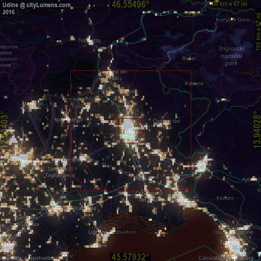
Analysis of Udine night lights 2016
Square area 10x10 km:
 16.9%
16.9%90-99
24.43%80-89
7.24%70-79
3.69%60-69
4.26%50-59
8.81%40-49
6.39%30-39
10.65%20-29
15.34%10-19
2.27%0-9
0%Square area 50x50 km:
1.45%90-99
2.96%80-89
1.44%70-79
1.48%60-69
2.18%50-59
2.9%40-49
2.85%30-39
3.4%20-29
6.11%10-19
23.23%0-9
51.99%Clear (daylight) street map image can be seen on geolist.org.
Map coordinates:
46° 33' 17.9" North, 12° 32' 2.5" East
46° 4' 9.5" North, 13° 14' 13.7" East
45° 34' 45.6" North, 13° 56' 25" East
Some cities around Udine sort by population:
• Tavagnacco
4.6 km =2.9 mi,  345°
345°
• Cividale del Friuli
14.9 km =9.3 mi,  81°
81°
• Tarcento
16 km =9.9 mi, 353°
• Buia
18.4 km =11.4 mi,  329°
329°
• Tricesimo
10.3 km =6.4 mi, 350°
• Pasian di Prato
4.6 km =2.9 mi,  236°
236°
• Manzano
14 km =8.7 mi,  129°
129°
• Martignacco
8 km =5 mi,  289°
289°
3165072 (p: 97,761)
Sources (retrieved 2019-11-25):
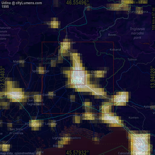
» NASA, Earths city lights 1995
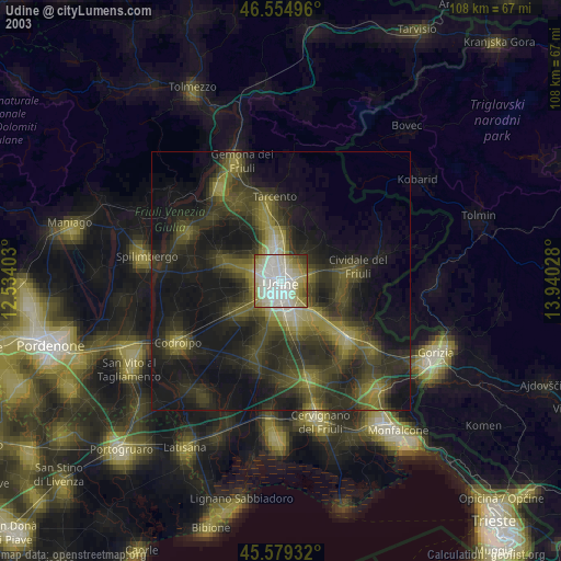
» NASA city lights 2003
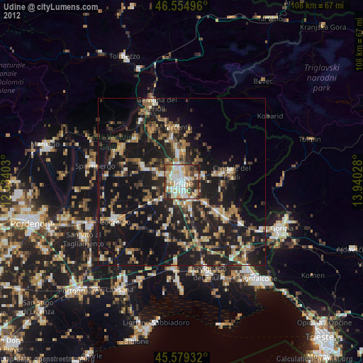
» Earth at Night: Flat Maps 2012, 2016