Terlizzi night lights from space
Night Light of Terlizzi (Apulia) from space (Italy) Src. Average luminocity for 10x10km area is 36.1412% and for 50x50km: 19.837%.
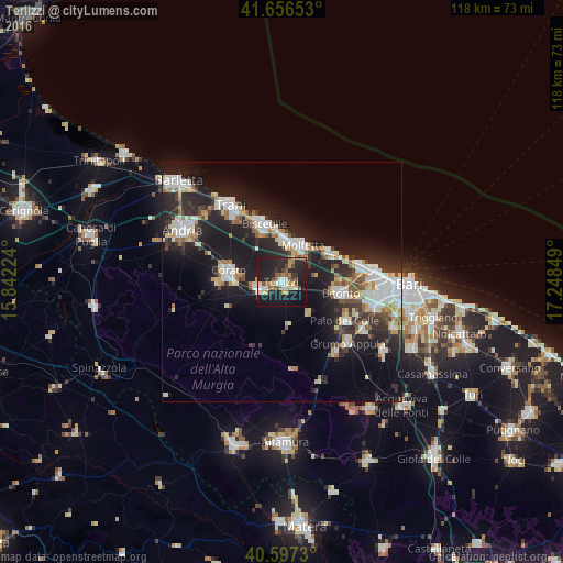
Analysis of Terlizzi night lights 2016
Square area 10x10 km:
 3.9%
3.9%90-99
4.55%80-89
4.38%70-79
3.73%60-69
5.52%50-59
6.82%40-49
3.9%30-39
3.9%20-29
20.29%10-19
41.4%0-9
1.62%Square area 50x50 km:
3.94%90-99
3.82%80-89
2.01%70-79
1.7%60-69
1.93%50-59
1.81%40-49
1.67%30-39
2.91%20-29
8.13%10-19
16.89%0-9
55.2%Clear (daylight) street map image can be seen on geolist.org.
Map coordinates:
41° 39' 23.5" North, 15° 50' 32.1" East
41° 7' 44.6" North, 16° 32' 43.3" East
40° 35' 50.3" North, 17° 14' 54.6" East
Some cities around Terlizzi sort by population:
• Molfetta
9.1 km =5.7 mi,  29°
29°
• Bisceglie
13.2 km =8.2 mi,  343°
343°
• Bitonto
12.4 km =7.7 mi,  99°
99°
• Corato
11.5 km =7.1 mi,  282°
282°
• Ruvo di Puglia
5.3 km =3.3 mi,  256°
256°
• Palo del Colle
15.5 km =9.6 mi,  121°
121°
• Giovinazzo
12.2 km =7.6 mi,  59°
59°
• Toritto
18.4 km =11.4 mi,  142°
142°
3165788 (p: 25,811)
Sources (retrieved 2019-11-25):
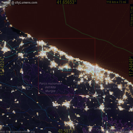
» Earth at Night: Flat Maps 2012, 2016