Toritto night lights from space
Night Light of Toritto (Apulia) from space (Italy) Src. Average luminocity for 10x10km area is 19.051% and for 50x50km: 24.861%.
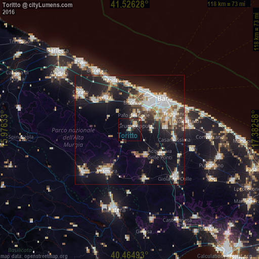
Analysis of Toritto night lights 2016
Square area 10x10 km:
 2.89%
2.89%90-99
1.36%80-89
2.21%70-79
1.87%60-69
2.21%50-59
0.68%40-49
2.72%30-39
5.95%20-29
6.29%10-19
18.2%0-9
55.61%Square area 50x50 km:
5.03%90-99
4.6%80-89
2.76%70-79
2.32%60-69
2.64%50-59
2.5%40-49
2.36%30-39
3.88%20-29
7.14%10-19
18.79%0-9
47.99%Clear (daylight) street map image can be seen on geolist.org.
Map coordinates:
41° 31' 34.6" North, 15° 58' 34.8" East
40° 59' 51.9" North, 16° 40' 46" East
40° 27' 53.7" North, 17° 22' 57.3" East
Some cities around Toritto sort by population:
• Bitonto
12.5 km =7.8 mi,  4°
4°
• Modugno
13 km =8.1 mi,  42°
42°
• Palo del Colle
6.7 km =4.2 mi,  17°
17°
• Grumo Appula
2.8 km =1.7 mi,  58°
58°
• Cassano delle Murge
13.9 km =8.6 mi,  148°
148°
• Bitetto
7.5 km =4.7 mi,  49°
49°
• Bitritto
13.4 km =8.3 mi,  67°
67°
• Sannicandro di Bari
9.9 km =6.2 mi,  88°
88°
3165513 (p: 8,060)
Sources (retrieved 2019-11-25):
» Earth at Night: Flat Maps 2012, 2016