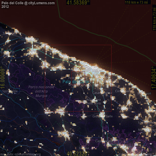
Palo del Colle night lights from space
Night Light of Palo del Colle (Apulia) from space (Italy) Src. Average luminocity for 10x10km area is 43.0146% and for 50x50km: 24.6326%.
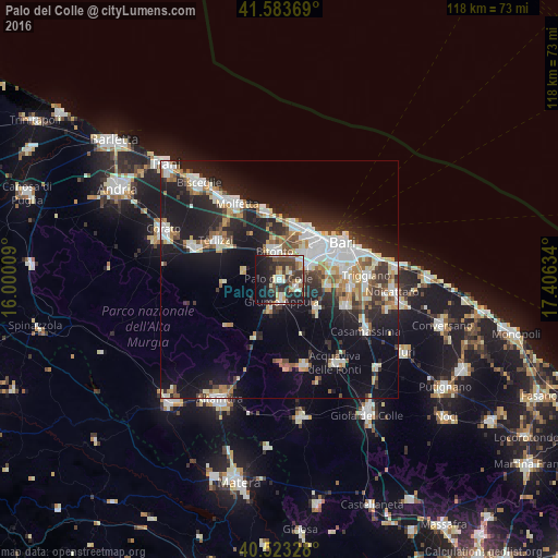
Analysis of Palo del Colle night lights 2016
Square area 10x10 km:
 5.68%
5.68%90-99
7.79%80-89
7.31%70-79
3.9%60-69
2.27%50-59
5.36%40-49
8.77%30-39
13.31%20-29
17.69%10-19
23.86%0-9
4.06%Square area 50x50 km:
5.14%90-99
4.5%80-89
2.69%70-79
2.3%60-69
2.69%50-59
2.6%40-49
2.26%30-39
3.8%20-29
7.65%10-19
17.79%0-9
48.58%Clear (daylight) street map image can be seen on geolist.org.
Map coordinates:
41° 35' 1.3" North, 16° 0' 0.3" East
41° 3' 20.2" North, 16° 42' 11.6" East
40° 31' 23.8" North, 17° 24' 22.8" East
Some cities around Palo del Colle sort by population:
• Bitonto
6.1 km =3.8 mi,  350°
350°
• Modugno
7.4 km =4.6 mi,  64°
64°
• San Paolo
10.7 km =6.6 mi,  44°
44°
• Grumo Appula
5 km =3.1 mi,  174°
174°
• Bitetto
4.1 km =2.5 mi,  112°
112°
• Bitritto
10.5 km =6.5 mi,  97°
97°
• Sannicandro di Bari
10 km =6.2 mi,  127°
127°
• Toritto
6.7 km =4.2 mi,  197°
197°
3171562 (p: 20,692)
Sources (retrieved 2019-11-25):
» Earth at Night: Flat Maps 2012, 2016