Spinazzola night lights from space
Night Light of Spinazzola (Apulia) from space (Italy) Src. Average luminocity for 10x10km area is 5.1139% and for 50x50km: 3.0796%.
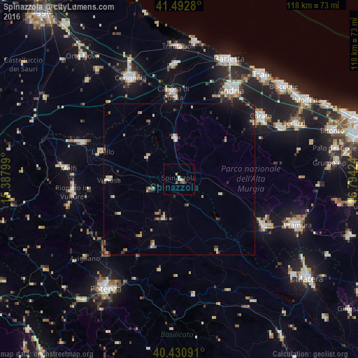
Analysis of Spinazzola night lights 2016
Square area 10x10 km:
 0.34%
0.34%90-99
1.02%80-89
0.68%70-79
0.68%60-69
0.85%50-59
1.19%40-49
0.68%30-39
0.68%20-29
0%10-19
0.68%0-9
93.2%Square area 50x50 km:
0.21%90-99
0.45%80-89
0.41%70-79
0.41%60-69
0.4%50-59
0.38%40-49
0.4%30-39
0.42%20-29
0.49%10-19
1.44%0-9
95%Clear (daylight) street map image can be seen on geolist.org.
Map coordinates:
41° 29' 34.1" North, 15° 23' 16.8" East
40° 57' 50.4" North, 16° 5' 28" East
40° 25' 51.3" North, 16° 47' 39.3" East
Some cities around Spinazzola sort by population:
• Andria
34.4 km =21.4 mi,  30°
30°
• Corato
34 km =21.1 mi,  52°
52°
• Gravina in Puglia
32 km =19.9 mi,  120°
120°
• Canosa di Puglia
28.5 km =17.7 mi,  356°
356°
• Lavello
27 km =16.8 mi,  290°
290°
• Venosa
23.4 km =14.5 mi,  269°
269°
• Minervino Murge
13.2 km =8.2 mi, 355°
• Genzano di Lucania
14.1 km =8.8 mi,  200°
200°
3166253 (p: 6,613)
Sources (retrieved 2019-11-25):
» Earth at Night: Flat Maps 2012, 2016