Sava night lights from space
Night Light of Sava (Apulia) from space (Italy) Src. Average luminocity for 10x10km area is 28.8112% and for 50x50km: 17.1712%.
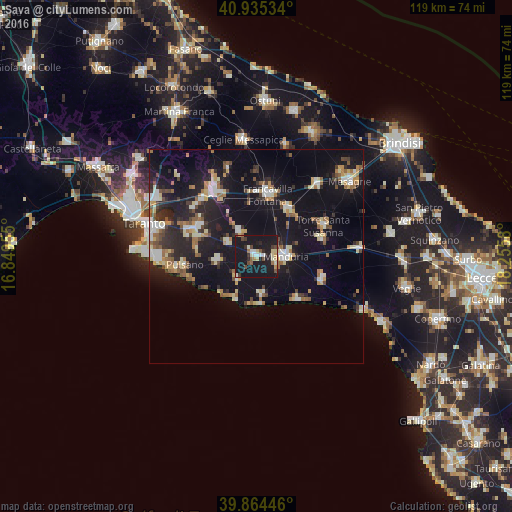
Analysis of Sava night lights 2016
Square area 10x10 km:
 2.72%
2.72%90-99
4.76%80-89
4.25%70-79
1.36%60-69
2.55%50-59
2.55%40-49
4.59%30-39
3.06%20-29
5.61%10-19
68.03%0-9
0.51%Square area 50x50 km:
1.79%90-99
2.68%80-89
2.04%70-79
1.62%60-69
2.18%50-59
2.1%40-49
2.01%30-39
1.74%20-29
5.2%10-19
21.86%0-9
56.77%Clear (daylight) street map image can be seen on geolist.org.
Map coordinates:
40° 56' 7.2" North, 16° 50' 58.4" East
40° 24' 7.3" North, 17° 33' 9.6" East
39° 51' 52.1" North, 18° 15' 20.9" East
Some cities around Sava sort by population:
• Francavilla Fontana
14.6 km =9.1 mi,  10°
10°
• Manduria
7.2 km =4.5 mi,  92°
92°
• Oria
13.3 km =8.3 mi,  34°
34°
• San Giorgio Ionico
15.9 km =9.9 mi,  293°
293°
• Lizzano
9.1 km =5.7 mi,  263°
263°
• San Marzano di San Giuseppe
7.2 km =4.5 mi,  324°
324°
• Carosino
14.8 km =9.2 mi,  298°
298°
• Fragagnano
7.2 km =4.5 mi, 295°
3167044 (p: 15,898)
Sources (retrieved 2019-11-25):
» Earth at Night: Flat Maps 2012, 2016