Sapri night lights from space
Night Light of Sapri (Campania) from space (Italy) Src. Average luminocity for 10x10km area is 10.6071% and for 50x50km: 4.8348%.
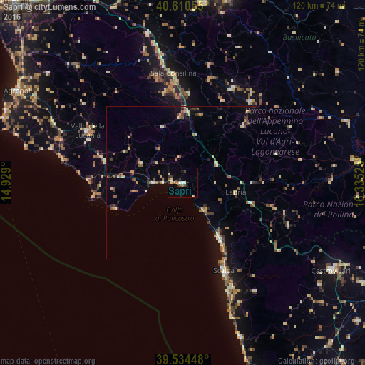
Analysis of Sapri night lights 2016
Square area 10x10 km:
 0.49%
0.49%90-99
1.95%80-89
1.46%70-79
0.65%60-69
1.95%50-59
1.46%40-49
0.65%30-39
2.76%20-29
1.62%10-19
1.95%0-9
85.06%Square area 50x50 km:
0.25%90-99
0.63%80-89
0.6%70-79
0.52%60-69
0.65%50-59
0.85%40-49
0.7%30-39
0.79%20-29
0.8%10-19
1.51%0-9
92.7%Clear (daylight) street map image can be seen on geolist.org.
Map coordinates:
40° 36' 38" North, 14° 55' 44.4" East
40° 4' 28.7" North, 15° 37' 55.6" East
39° 32' 4.1" North, 16° 20' 6.9" East
Some cities around Sapri sort by population:
• Sala Consilina
36.5 km =22.7 mi,  354°
354°
• Scalea
33 km =20.5 mi,  154°
154°
• Vallo della Lucania
35.4 km =22 mi,  298°
298°
• Praia a Mare
23.9 km =14.9 mi, 147°
• Senise
56.4 km =35 mi,  81°
81°
• Belvedere Marittimo
54.3 km =33.7 mi,  158°
158°
• Polla
50.2 km =31.2 mi, 346°
• Lagonegro
12.5 km =7.8 mi,  61°
61°
3167152 (p: 6,716)
Sources (retrieved 2019-11-25):
» Earth at Night: Flat Maps 2012, 2016