San Sperate night lights from space
Night Light of San Sperate (Sardinia) from space (Italy) Src. Average luminocity for 10x10km area is 30.2347% and for 50x50km: 15.9193%.
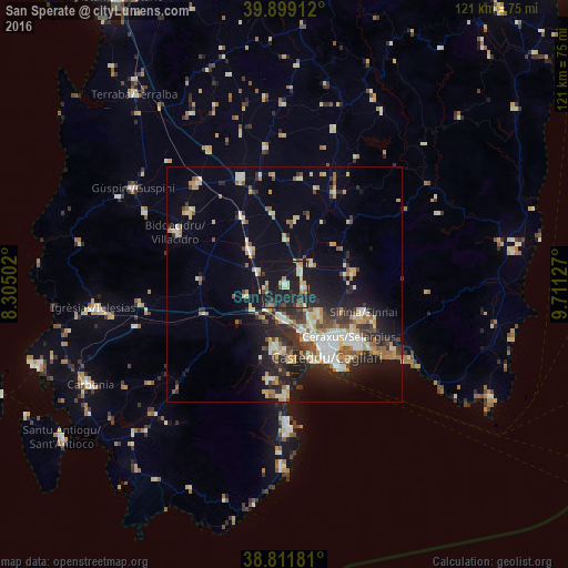
Analysis of San Sperate night lights 2016
Square area 10x10 km:
 1.36%
1.36%90-99
4.59%80-89
4.59%70-79
4.25%60-69
4.25%50-59
3.57%40-49
3.06%30-39
3.91%20-29
11.56%10-19
47.79%0-9
11.05%Square area 50x50 km:
1.68%90-99
2.93%80-89
2.22%70-79
2.03%60-69
2.01%50-59
1.67%40-49
1.8%30-39
2.39%20-29
4.95%10-19
9.88%0-9
68.45%Clear (daylight) street map image can be seen on geolist.org.
Map coordinates:
39° 53' 56.8" North, 8° 18' 18.1" East
39° 21' 27.3" North, 9° 0' 29.3" East
38° 48' 42.5" North, 9° 42' 40.6" East
Some cities around San Sperate sort by population:
• Assemini
7.4 km =4.6 mi,  186°
186°
• Sestu
9.8 km =6.1 mi,  132°
132°
• Dolianova
14.7 km =9.1 mi,  81°
81°
• Serramanna
10.4 km =6.5 mi,  314°
314°
• Elmas
10.5 km =6.5 mi,  159°
159°
• Decimomannu
6.2 km =3.9 mi,  212°
212°
• Uta
8.7 km =5.4 mi, 213°
• Villasor
6.2 km =3.9 mi,  295°
295°
2523255 (p: 7,158)
Sources (retrieved 2019-11-25):
» Earth at Night: Flat Maps 2012, 2016