San Severo night lights from space
Night Light of San Severo (Apulia) from space (Italy) Src. Average luminocity for 10x10km area is 24.0406% and for 50x50km: 6.0159%.
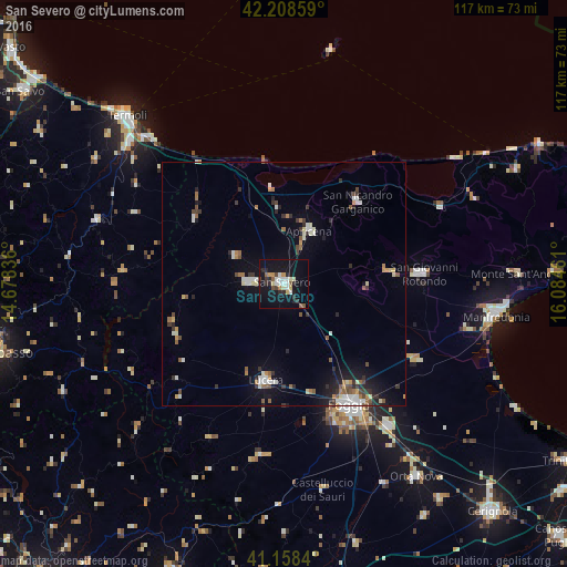

Analysis of San Severo night lights 2016
Square area 10x10 km:
 4.38%
4.38%90-99
3.08%80-89
3.08%70-79
2.6%60-69
0.81%50-59
3.08%40-49
1.79%30-39
2.44%20-29
6.01%10-19
34.9%0-9
37.82%Square area 50x50 km:
0.83%90-99
1.07%80-89
0.49%70-79
0.51%60-69
0.69%50-59
0.77%40-49
0.64%30-39
0.91%20-29
1.18%10-19
4.03%0-9
88.89%Clear (daylight) street map image can be seen on geolist.org.
Map coordinates:
42° 12' 30.9" North, 14° 40' 42.1" East
41° 41' 8.3" North, 15° 22' 53.3" East
41° 9' 30.2" North, 16° 5' 4.6" East
Some cities around San Severo sort by population:
• Lucera
20.3 km =12.6 mi,  189°
189°
• San Giovanni Rotondo
28.8 km =17.9 mi,  85°
85°
• Torremaggiore
7.3 km =4.5 mi,  272°
272°
• Sannicandro Garganico
22.8 km =14.2 mi,  41°
41°
• San Marco in Lamis
21.5 km =13.4 mi,  82°
82°
• Apricena
12.3 km =7.6 mi,  24°
24°
• Lesina
19.7 km =12.2 mi,  353°
353°
• San Paolo di Civitate
11.6 km =7.2 mi,  300°
300°
3167731 (p: 54,880)
Sources (retrieved 2019-11-25):
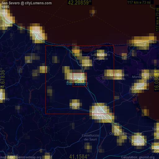
» NASA, Earths city lights 1995
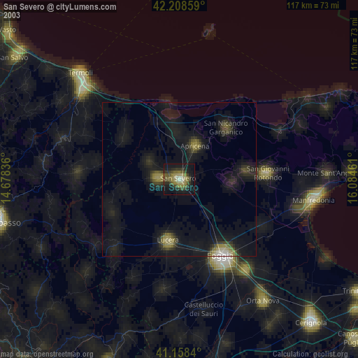
» NASA city lights 2003
» Earth at Night: Flat Maps 2012, 2016