San Felice sul Panaro night lights from space
Night Light of San Felice sul Panaro (Emilia-Romagna) from space (Italy) Src. Average luminocity for 10x10km area is 23.7286% and for 50x50km: 26.6075%.
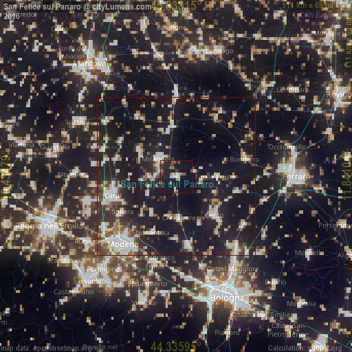
Analysis of San Felice sul Panaro night lights 2016
Square area 10x10 km:
 2.06%
2.06%90-99
4.29%80-89
1.9%70-79
0.95%60-69
2.22%50-59
4.6%40-49
1.9%30-39
3.97%20-29
9.68%10-19
35.71%0-9
32.7%Square area 50x50 km:
3.57%90-99
4.88%80-89
2.83%70-79
2.02%60-69
2.37%50-59
2.87%40-49
3.82%30-39
3.98%20-29
8.01%10-19
33.98%0-9
31.65%Clear (daylight) street map image can be seen on geolist.org.
Map coordinates:
45° 19' 59.3" North, 10° 26' 5.2" East
44° 50' 12.2" North, 11° 8' 16.5" East
44° 20' 9.4" North, 11° 50' 27.7" East
Some cities around San Felice sul Panaro sort by population:
• Cento
16.6 km =10.3 mi,  134°
134°
• Mirandola
7.6 km =4.7 mi,  314°
314°
• Finale Emilia
12.3 km =7.6 mi,  91°
91°
• Crevalcore
13 km =8.1 mi,  176°
176°
• Pieve di Cento
19.3 km =12 mi,  135°
135°
• Poggio Rusco
14.7 km =9.1 mi,  349°
349°
• Cavezzo
8.6 km =5.3 mi,  268°
268°
• Decima
15.8 km =9.8 mi,  152°
152°
3168389 (p: 7,156)
Sources (retrieved 2019-11-25):
» Earth at Night: Flat Maps 2012, 2016