Romano Banco night lights from space
Night Light of Romano Banco (Lombardy) from space (Italy) Src. Average luminocity for 10x10km area is 83.5587% and for 50x50km: 63.7146%.
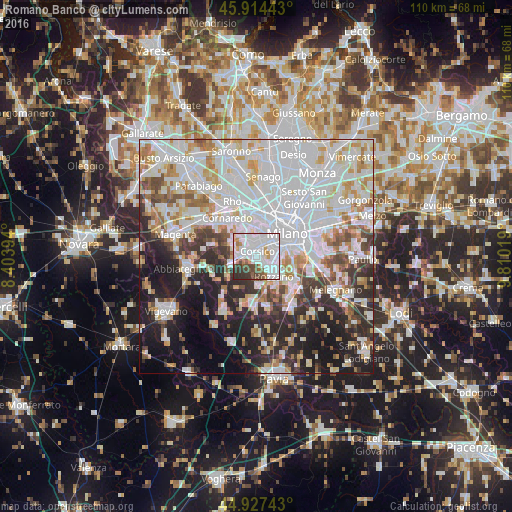
Analysis of Romano Banco night lights 2016
Square area 10x10 km:
 38.25%
90-99
29.05%80-89
1.75%70-79
5.4%60-69
3.33%50-59
5.56%40-49
6.83%30-39
6.98%20-29
2.86%10-19
0%0-9
0%Square area 50x50 km:
25.24%90-99
15.71%80-89
5.36%70-79
5.75%60-69
5.59%50-59
4.2%40-49
4.53%30-39
5.53%20-29
10.08%10-19
12.63%0-9
5.37%Clear (daylight) street map image can be seen on geolist.org.
Map coordinates:
45° 54' 51.9" North, 8° 24' 14.2" East
45° 25' 23.1" North, 9° 6' 25.5" East
44° 55' 38.7" North, 9° 48' 36.7" East
Some cities around Romano Banco sort by population:
• Milan
7.9 km =4.9 mi,  54°
54°
• Rozzano
6 km =3.7 mi,  140°
140°
• Corsico
0.9 km =0.6 mi,  18°
18°
• Cesano Boscone
2.3 km =1.4 mi,  334°
334°
• Trezzano sul Naviglio
3.4 km =2.1 mi,  268°
268°
• Settimo Milanese
7.3 km =4.5 mi, 326°
• Assago
2.1 km =1.3 mi, 137°
• Gaggiano
6 km =3.7 mi,  250°
250°
8948705 (p: 26,163)
Sources (retrieved 2019-11-25):
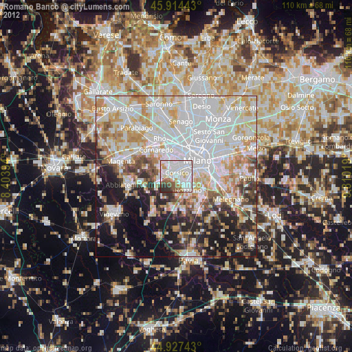
» Earth at Night: Flat Maps 2012, 2016