Assago night lights from space
Night Light of Assago (Lombardy) from space (Italy) Src. Average luminocity for 10x10km area is 82.6143% and for 50x50km: 62.3154%.
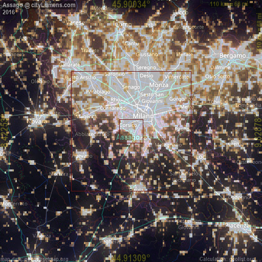
Analysis of Assago night lights 2016
Square area 10x10 km:
 36.83%
90-99
28.57%80-89
2.22%70-79
5.24%60-69
3.81%50-59
5.71%40-49
7.14%30-39
7.46%20-29
3.02%10-19
0%0-9
0%Square area 50x50 km:
24.37%90-99
15.32%80-89
5.16%70-79
5.44%60-69
5.44%50-59
4.26%40-49
4.55%30-39
5.73%20-29
10.71%10-19
12.93%0-9
6.08%Clear (daylight) street map image can be seen on geolist.org.
Map coordinates:
45° 54' 1.2" North, 8° 25' 21.1" East
45° 24' 31.9" North, 9° 7' 32.3" East
44° 54' 47.1" North, 9° 49' 43.6" East
Some cities around Assago sort by population:
• Rozzano
3.8 km =2.4 mi,  141°
141°
• Corsico
2.7 km =1.7 mi,  334°
334°
• Romano Banco
2.1 km =1.3 mi,  317°
317°
• Cesano Boscone
4.4 km =2.7 mi, 326°
• Trezzano sul Naviglio
5.1 km =3.2 mi,  286°
286°
• Opera
7.7 km =4.8 mi,  120°
120°
• Basiglio
6.1 km =3.8 mi,  155°
155°
• Gaggiano
7.1 km =4.4 mi,  266°
266°
6534466 (p: 7,917)
Sources (retrieved 2019-11-25):
» Earth at Night: Flat Maps 2012, 2016