Carpi Centro night lights from space
Night Light of Carpi Centro (Emilia-Romagna) from space (Italy) Src. Average luminocity for 10x10km area is 56.4621% and for 50x50km: 37.2932%.
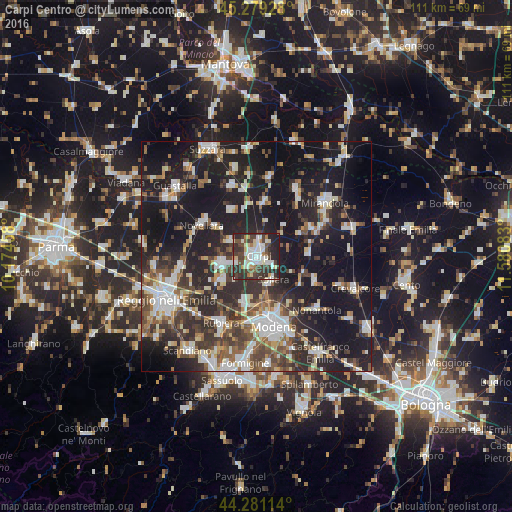

Analysis of Carpi Centro night lights 2016
Square area 10x10 km:
 10.91%
90-99
15.45%80-89
6.52%70-79
3.03%60-69
4.24%50-59
3.33%40-49
14.85%30-39
19.09%20-29
17.73%10-19
4.85%0-9
0%Square area 50x50 km:
6.17%90-99
7.54%80-89
3.24%70-79
2.86%60-69
3.73%50-59
5.23%40-49
6.16%30-39
7.16%20-29
13.36%10-19
33.36%0-9
11.21%Clear (daylight) street map image can be seen on geolist.org.
Map coordinates:
45° 16' 45.4" North, 10° 10' 28.5" East
44° 46' 56.5" North, 10° 52' 39.7" East
44° 16' 52.1" North, 11° 34' 51" East
Some cities around Carpi Centro sort by population:
• Correggio
7.6 km =4.7 mi,  257°
257°
• Soliera
6.4 km =4 mi,  147°
147°
• Campogalliano
10.7 km =6.6 mi,  193°
193°
• Fabbrico
11.4 km =7.1 mi,  331°
331°
• San Martino in Rio
9.1 km =5.7 mi,  233°
233°
• Novi di Modena
12.1 km =7.5 mi,  8°
8°
• Cavezzo
13.3 km =8.3 mi,  63°
63°
• Rio Saliceto
6.6 km =4.1 mi,  299°
299°
3180445 (p: 53,024)
Sources (retrieved 2019-11-25):
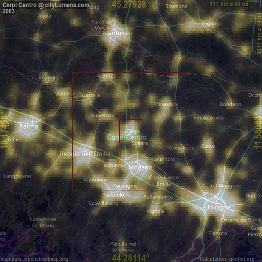
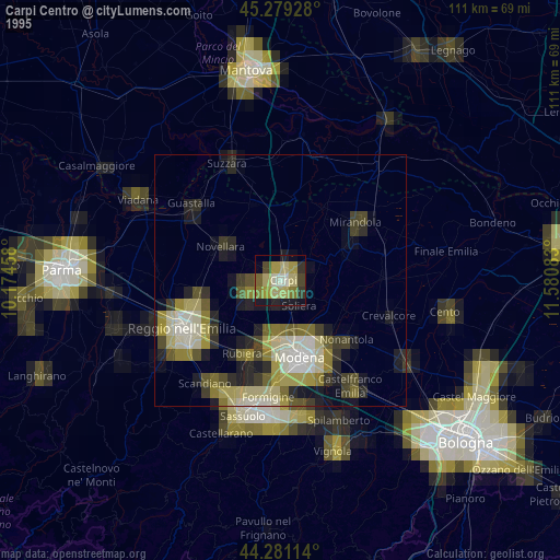
» NASA, Earths city lights 1995
» NASA city lights 2003
» Earth at Night: Flat Maps 2012, 2016