Fabbrico night lights from space
Night Light of Fabbrico (Emilia-Romagna) from space (Italy) Src. Average luminocity for 10x10km area is 29.8413% and for 50x50km: 33.2079%.
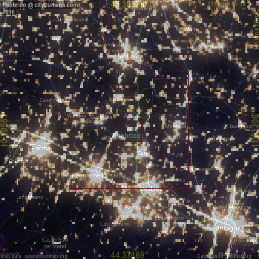
Analysis of Fabbrico night lights 2016
Square area 10x10 km:
 4.29%
4.29%90-99
4.6%80-89
3.33%70-79
1.11%60-69
1.11%50-59
3.81%40-49
1.11%30-39
1.27%20-29
23.02%10-19
56.03%0-9
0.32%Square area 50x50 km:
4.92%90-99
6.41%80-89
2.88%70-79
2.59%60-69
3.2%50-59
4.03%40-49
4.86%30-39
5.81%20-29
13.78%10-19
35.87%0-9
15.64%Clear (daylight) street map image can be seen on geolist.org.
Map coordinates:
45° 22' 5.8" North, 10° 6' 20.9" East
44° 52' 19.7" North, 10° 48' 32.1" East
44° 22' 18.1" North, 11° 30' 43.4" East
Some cities around Fabbrico sort by population:
• Carpi Centro
11.4 km =7.1 mi,  151°
151°
• Correggio
11.8 km =7.3 mi,  189°
189°
• Guastalla
12.4 km =7.7 mi,  290°
290°
• Novellara
7.1 km =4.4 mi,  244°
244°
• Reggiolo
5.1 km =3.2 mi,  1°
1°
• Novi di Modena
7.5 km =4.7 mi,  74°
74°
• Gonzaga
8.9 km =5.5 mi,  5°
5°
• Rio Saliceto
6.8 km =4.2 mi,  183°
183°
3177317 (p: 6,149)
Sources (retrieved 2019-11-25):
» Earth at Night: Flat Maps 2012, 2016