Reggio nell'Emilia night lights from space
Night Light of Reggio nell'Emilia (Emilia-Romagna) from space (Italy) Src. Average luminocity for 10x10km area is 75.7652% and for 50x50km: 38.674%.
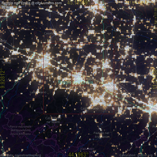
Analysis of Reggio nell'Emilia night lights 2016
Square area 10x10 km:
 23.18%
90-99
23.18%80-89
5.45%70-79
6.82%60-69
9.7%50-59
10%40-49
11.06%30-39
9.85%20-29
0.76%10-19
0%0-9
0%Square area 50x50 km:
6.87%90-99
8.12%80-89
3.48%70-79
3.25%60-69
4.04%50-59
5.1%40-49
6.52%30-39
8.2%20-29
16.42%10-19
21.55%0-9
16.45%Clear (daylight) street map image can be seen on geolist.org.
Map coordinates:
45° 11' 45.2" North, 9° 55' 41.2" East
44° 41' 53.7" North, 10° 37' 52.5" East
44° 11' 46.7" North, 11° 20' 3.8" East
Some cities around Reggio nell'Emilia sort by population:
• Rubiera
12.8 km =8 mi,  113°
113°
• Scandiano
12.2 km =7.6 mi,  155°
155°
• Cavriago
8.3 km =5.2 mi,  267°
267°
• Bagnolo in Piano
8.1 km =5 mi,  24°
24°
• Castelnovo di Sotto
13.7 km =8.5 mi,  338°
338°
• Cadelbosco di Sopra
7.9 km =4.9 mi, 341°
• San Martino in Rio
12.8 km =8 mi,  72°
72°
• Bibbiano
13 km =8.1 mi,  252°
252°
3169522 (p: 133,296)
Sources (retrieved 2019-11-25):
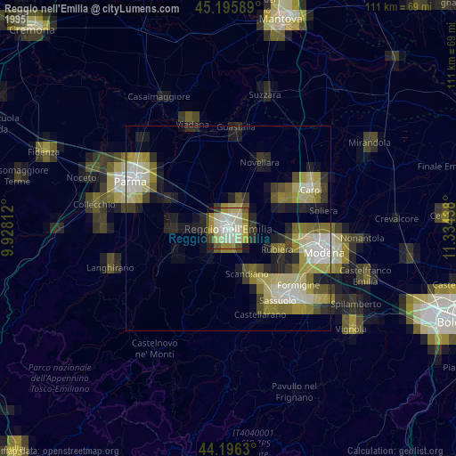
» NASA, Earths city lights 1995
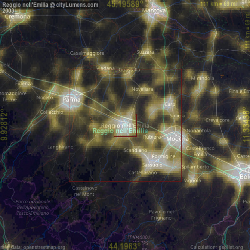
» NASA city lights 2003
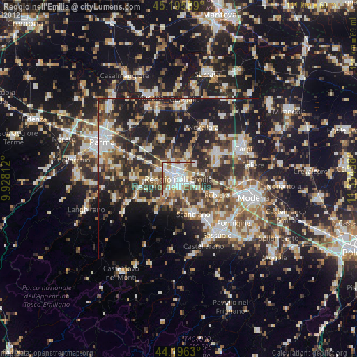
» Earth at Night: Flat Maps 2012, 2016