Polignano a Mare night lights from space
Night Light of Polignano a Mare (Apulia) from space (Italy) Src. Average luminocity for 10x10km area is 35.3878% and for 50x50km: 15.9315%.
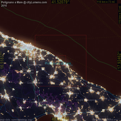
Analysis of Polignano a Mare night lights 2016
Square area 10x10 km:
 3.4%
3.4%90-99
6.8%80-89
6.63%70-79
1.36%60-69
5.61%50-59
3.23%40-49
6.29%30-39
4.08%20-29
15.99%10-19
34.69%0-9
11.9%Square area 50x50 km:
1.69%90-99
2.38%80-89
2.08%70-79
1.41%60-69
1.87%50-59
2.05%40-49
1.87%30-39
3.03%20-29
5.42%10-19
18.28%0-9
59.93%Clear (daylight) street map image can be seen on geolist.org.
Map coordinates:
41° 31' 14.8" North, 16° 31' 6.1" East
40° 59' 32" North, 17° 13' 17.4" East
40° 27' 33.7" North, 17° 55' 28.6" East
Some cities around Polignano a Mare sort by population:
• Monopoli
8 km =5 mi,  126°
126°
• Mola di Bari
13.4 km =8.3 mi,  304°
304°
• Putignano
17.8 km =11.1 mi,  208°
208°
• Conversano
9.5 km =5.9 mi,  253°
253°
• Noicattaro
20 km =12.4 mi,  283°
283°
• Rutigliano
18.2 km =11.3 mi, 276°
• Castellana
12.7 km =7.9 mi,  201°
201°
• Turi
18.9 km =11.7 mi,  243°
243°
3170382 (p: 13,356)
Sources (retrieved 2019-11-25):
» Earth at Night: Flat Maps 2012, 2016