Putignano night lights from space
Night Light of Putignano (Apulia) from space (Italy) Src. Average luminocity for 10x10km area is 34.0748% and for 50x50km: 20.5155%.
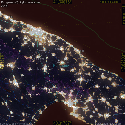

Analysis of Putignano night lights 2016
Square area 10x10 km:
 5.95%
5.95%90-99
6.8%80-89
2.55%70-79
2.21%60-69
4.76%50-59
3.23%40-49
4.25%30-39
4.59%20-29
10.2%10-19
42.86%0-9
12.59%Square area 50x50 km:
2.34%90-99
3.05%80-89
2.47%70-79
2%60-69
2.71%50-59
2.49%40-49
2.33%30-39
3.76%20-29
6.57%10-19
21.48%0-9
50.81%Clear (daylight) street map image can be seen on geolist.org.
Map coordinates:
41° 22' 50.8" North, 16° 25' 7.6" East
40° 51' 3.8" North, 17° 7' 18.8" East
40° 19' 1.5" North, 17° 49' 30.1" East
Some cities around Putignano sort by population:
• Gioia del Colle
17.7 km =11 mi,  251°
251°
• Conversano
13.1 km =8.1 mi,  356°
356°
• Noci
6.4 km =4 mi,  176°
176°
• Castellana
5.4 km =3.4 mi,  42°
42°
• Polignano a Mare
17.8 km =11.1 mi,  28°
28°
• Turi
11.2 km =7 mi,  310°
310°
• Alberobello
12.1 km =7.5 mi,  127°
127°
• Sammichele di Bari
15.1 km =9.4 mi,  285°
285°
3169742 (p: 23,661)
Sources (retrieved 2019-11-25):
» Earth at Night: Flat Maps 2012, 2016