Turi night lights from space
Night Light of Turi (Apulia) from space (Italy) Src. Average luminocity for 10x10km area is 14.4643% and for 50x50km: 23.8557%.
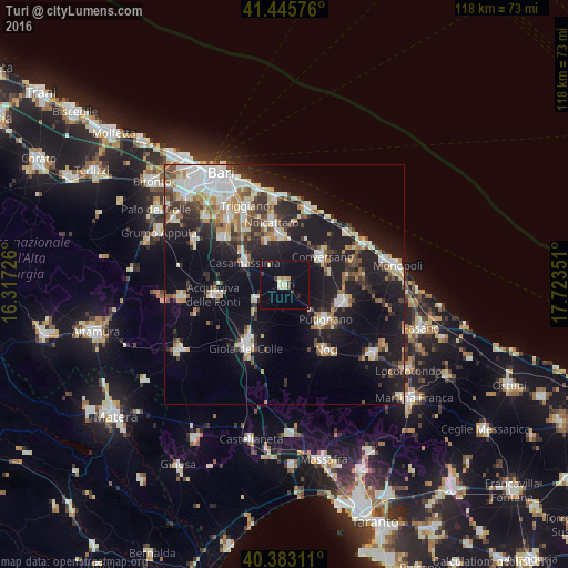
Analysis of Turi night lights 2016
Square area 10x10 km:
 0.68%
0.68%90-99
2.72%80-89
2.72%70-79
1.36%60-69
0%50-59
0%40-49
1.53%30-39
1.87%20-29
0.68%10-19
11.73%0-9
76.7%Square area 50x50 km:
4.54%90-99
4.21%80-89
2.71%70-79
2.07%60-69
2.57%50-59
2.47%40-49
2.46%30-39
3.84%20-29
6.14%10-19
20.35%0-9
48.64%Clear (daylight) street map image can be seen on geolist.org.
Map coordinates:
41° 26' 44.7" North, 16° 19' 2.1" East
40° 54' 59.7" North, 17° 1' 13.4" East
40° 22' 59.2" North, 17° 43' 24.6" East
Some cities around Turi sort by population:
• Putignano
11.2 km =7 mi,  130°
130°
• Conversano
9.7 km =6 mi,  53°
53°
• Noicattaro
13.4 km =8.3 mi,  348°
348°
• Casamassima
9.5 km =5.9 mi,  297°
297°
• Rutigliano
10.5 km =6.5 mi, 353°
• Castellana
12.6 km =7.8 mi,  105°
105°
• Sammichele di Bari
6.8 km =4.2 mi,  241°
241°
• Cellamare
13.9 km =8.6 mi,  325°
325°
3165094 (p: 11,813)
Sources (retrieved 2019-11-25):
» Earth at Night: Flat Maps 2012, 2016