Castellana night lights from space
Night Light of Castellana (Apulia) from space (Italy) Src. Average luminocity for 10x10km area is 32.8367% and for 50x50km: 20.5793%.
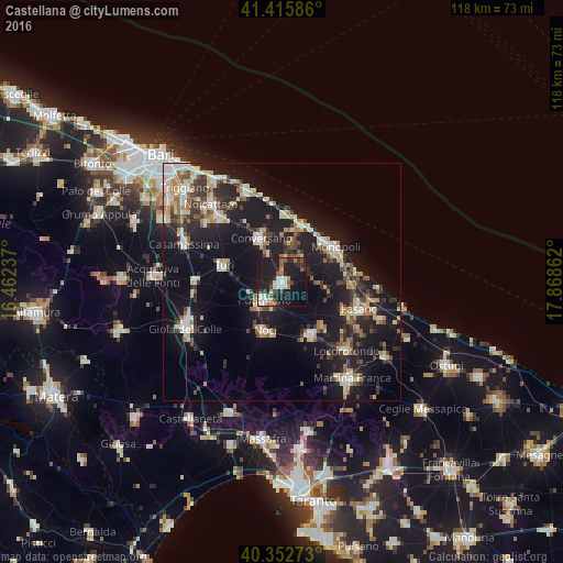
Analysis of Castellana night lights 2016
Square area 10x10 km:
 5.27%
5.27%90-99
5.27%80-89
1.53%70-79
3.23%60-69
2.21%50-59
6.97%40-49
2.72%30-39
6.46%20-29
10.2%10-19
46.6%0-9
9.52%Square area 50x50 km:
2.47%90-99
3.22%80-89
2.71%70-79
1.92%60-69
2.58%50-59
2.32%40-49
2.36%30-39
3.78%20-29
6.43%10-19
21.94%0-9
50.26%Clear (daylight) street map image can be seen on geolist.org.
Map coordinates:
41° 24' 57.1" North, 16° 27' 44.5" East
40° 53' 11.1" North, 17° 9' 55.8" East
40° 21' 9.8" North, 17° 52' 7" East
Some cities around Castellana sort by population:
• Monopoli
13.1 km =8.1 mi,  57°
57°
• Putignano
5.4 km =3.4 mi,  222°
222°
• Conversano
10.1 km =6.3 mi,  334°
334°
• Fasano
17.3 km =10.7 mi,  108°
108°
• Noci
10.8 km =6.7 mi,  197°
197°
• Polignano a Mare
12.7 km =7.9 mi,  21°
21°
• Turi
12.6 km =7.8 mi,  285°
285°
• Alberobello
12.8 km =8 mi,  152°
152°
3179656 (p: 14,485)
Sources (retrieved 2019-11-25):
» Earth at Night: Flat Maps 2012, 2016