Podenzano night lights from space
Night Light of Podenzano (Emilia-Romagna) from space (Italy) Src. Average luminocity for 10x10km area is 33.773% and for 50x50km: 18.2104%.
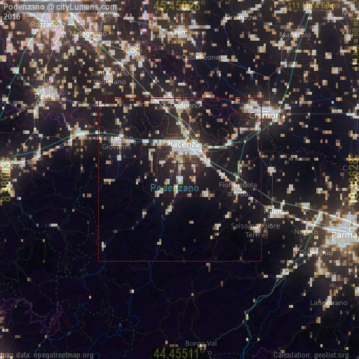
Analysis of Podenzano night lights 2016
Square area 10x10 km:
 2.38%
2.38%90-99
6.03%80-89
5.56%70-79
6.03%60-69
2.06%50-59
2.38%40-49
2.22%30-39
3.65%20-29
22.22%10-19
41.9%0-9
5.56%Square area 50x50 km:
2.5%90-99
3.46%80-89
1.73%70-79
1.6%60-69
1.78%50-59
2.08%40-49
2.03%30-39
2.63%20-29
5.57%10-19
21.05%0-9
55.57%Clear (daylight) street map image can be seen on geolist.org.
Map coordinates:
45° 27' 0.9" North, 8° 58' 48.1" East
44° 57' 17.4" North, 9° 40' 59.3" East
44° 27' 18.4" North, 10° 23' 10.6" East
Some cities around Podenzano sort by population:
• Piacenza
10.9 km =6.8 mi,  4°
4°
• Codogno
23.1 km =14.4 mi, 3°
• Fiorenzuola d'Arda
18.4 km =11.4 mi,  100°
100°
• Casalpusterlengo
25.1 km =15.6 mi,  353°
353°
• Castel San Giovanni
22.6 km =14 mi,  301°
301°
• San Nicolò
12.9 km =8 mi,  331°
331°
• Borgonovo Valtidone
20 km =12.4 mi,  289°
289°
• Pontenure
9.8 km =6.1 mi,  60°
60°
3170537 (p: 5,901)
Sources (retrieved 2019-11-25):
» Earth at Night: Flat Maps 2012, 2016