Fiorenzuola d'Arda night lights from space
Night Light of Fiorenzuola d'Arda (Emilia-Romagna) from space (Italy) Src. Average luminocity for 10x10km area is 26.3746% and for 50x50km: 19.6421%.
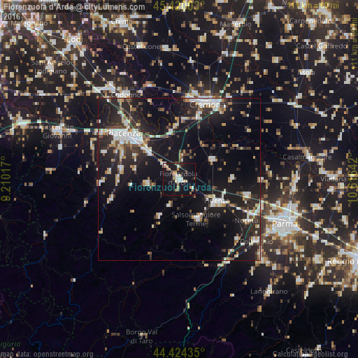
Analysis of Fiorenzuola d'Arda night lights 2016
Square area 10x10 km:
 4.13%
4.13%90-99
4.13%80-89
3.02%70-79
3.65%60-69
3.33%50-59
2.54%40-49
2.54%30-39
0.16%20-29
0.79%10-19
45.87%0-9
29.84%Square area 50x50 km:
2.79%90-99
3.71%80-89
1.54%70-79
1.86%60-69
1.94%50-59
1.73%40-49
2.07%30-39
3.17%20-29
7.19%10-19
21.46%0-9
52.53%Clear (daylight) street map image can be seen on geolist.org.
Map coordinates:
45° 25' 12.1" North, 9° 12' 36.6" East
44° 55' 27.7" North, 9° 54' 47.8" East
44° 25' 27.7" North, 10° 36' 59.1" East
Some cities around Fiorenzuola d'Arda sort by population:
• Piacenza
22.4 km =13.9 mi,  309°
309°
• Cremona
24.7 km =15.3 mi,  20°
20°
• Fidenza
13.2 km =8.2 mi,  118°
118°
• Salsomaggiore Terme
13.4 km =8.3 mi,  154°
154°
• San Nicolò
28.3 km =17.6 mi,  301°
301°
• Noceto
24.4 km =15.2 mi, 121°
• Podenzano
18.4 km =11.4 mi,  280°
280°
• Pontenure
12.6 km =7.8 mi, 310°
3176964 (p: 13,207)
Sources (retrieved 2019-11-25):
» Earth at Night: Flat Maps 2012, 2016