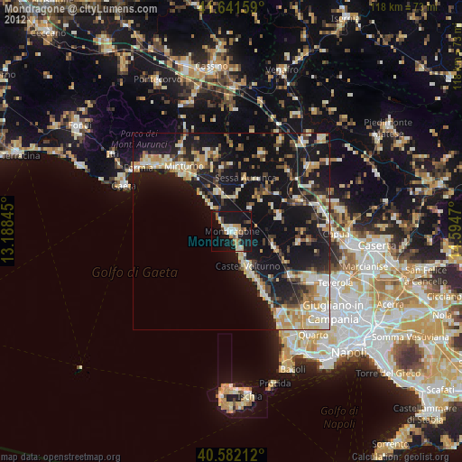
Mondragone night lights from space
Night Light of Mondragone (Campania) from space (Italy) Src. Average luminocity for 10x10km area is 29.4416% and for 50x50km: 20.1389%.
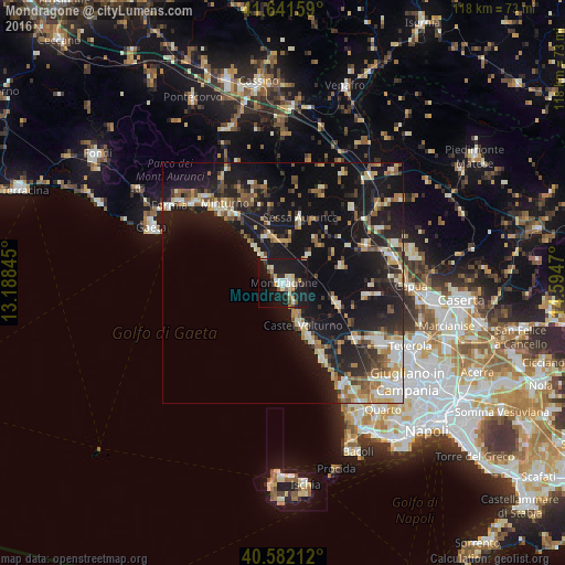
Analysis of Mondragone night lights 2016
Square area 10x10 km:
 3.73%
3.73%90-99
6.01%80-89
3.9%70-79
3.25%60-69
1.95%50-59
3.25%40-49
1.79%30-39
1.95%20-29
4.87%10-19
54.38%0-9
14.94%Square area 50x50 km:
1.86%90-99
3.93%80-89
2.03%70-79
2.41%60-69
2.48%50-59
3.08%40-49
2.21%30-39
2.44%20-29
6.02%10-19
24.7%0-9
48.84%Clear (daylight) street map image can be seen on geolist.org.
Map coordinates:
41° 38' 29.7" North, 13° 11' 18.4" East
41° 6' 50.4" North, 13° 53' 29.7" East
40° 34' 55.6" North, 14° 35' 40.9" East
Some cities around Mondragone sort by population:
• Castel Volturno
10 km =6.2 mi,  154°
154°
• Minturno
20.6 km =12.8 mi,  323°
323°
• Villa Literno
19.4 km =12.1 mi,  126°
126°
• Sparanise
19 km =11.8 mi,  64°
64°
• Cellole
10.4 km =6.5 mi,  342°
342°
• Grazzanise
17.6 km =10.9 mi,  98°
98°
• Sessa Aurunca
14.4 km =8.9 mi,  12°
12°
• Teano
21.2 km =13.2 mi,  43°
43°
3173160 (p: 26,076)
Sources (retrieved 2019-11-25):
» Earth at Night: Flat Maps 2012, 2016