Villa Literno night lights from space
Night Light of Villa Literno (Campania) from space (Italy) Src. Average luminocity for 10x10km area is 34.8622% and for 50x50km: 38.787%.
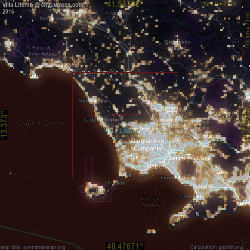
Analysis of Villa Literno night lights 2016
Square area 10x10 km:
 3.91%
3.91%90-99
4.93%80-89
3.4%70-79
2.72%60-69
3.57%50-59
3.57%40-49
7.48%30-39
8.16%20-29
20.07%10-19
41.67%0-9
0.51%Square area 50x50 km:
10.88%90-99
9.84%80-89
3.64%70-79
4.34%60-69
3.57%50-59
3.7%40-49
2.73%30-39
3.9%20-29
7.49%10-19
18.86%0-9
31.07%Clear (daylight) street map image can be seen on geolist.org.
Map coordinates:
41° 32' 16.3" North, 13° 22' 22.8" East
41° 0' 33.9" North, 14° 4' 34" East
40° 28' 36.2" North, 14° 46' 45.3" East
Some cities around Villa Literno sort by population:
• Casal di Principe
4.5 km =2.8 mi,  89°
89°
• Trentola-Ducenta
9.1 km =5.7 mi,  114°
114°
• San Cipriano d'Aversa
4.8 km =3 mi,  104°
104°
• San Marcellino
8.6 km =5.3 mi, 104°
• Parete
9.1 km =5.7 mi,  127°
127°
• Frignano
8.7 km =5.4 mi, 98°
• Casapesenna
5.4 km =3.4 mi, 111°
• Grazzanise
9.1 km =5.7 mi,  12°
12°
3164219 (p: 10,027)
Sources (retrieved 2019-11-25):
» Earth at Night: Flat Maps 2012, 2016