Meda night lights from space
Night Light of Meda (Lombardy) from space (Italy) Src. Average luminocity for 10x10km area is 95.0576% and for 50x50km: 75.3641%.
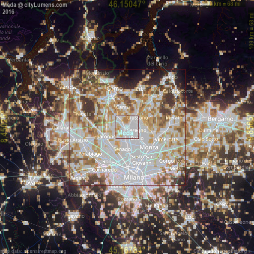
Analysis of Meda night lights 2016
Square area 10x10 km:
 62.42%
90-99
19.09%80-89
6.52%70-79
7.12%60-69
4.85%50-59
0%40-49
0%30-39
0%20-29
0%10-19
0%0-9
0%Square area 50x50 km:
28.51%90-99
19.29%80-89
7.22%70-79
8.75%60-69
9.03%50-59
6.75%40-49
5.59%30-39
5.65%20-29
3.93%10-19
3.64%0-9
1.64%Clear (daylight) street map image can be seen on geolist.org.
Map coordinates:
46° 9' 1.7" North, 8° 27' 0.9" East
45° 39' 40.4" North, 9° 9' 12.1" East
45° 10' 3.5" North, 9° 51' 23.4" East
Some cities around Meda sort by population:
• Seregno
4.2 km =2.6 mi,  107°
107°
• Cesano Maderno
3.6 km =2.2 mi,  181°
181°
• Seveso
1.8 km =1.1 mi,  206°
206°
• Mariano Comense
4.5 km =2.8 mi,  29°
29°
• Lentate sul Seveso
3.2 km =2 mi,  301°
301°
• Lazzate
5.5 km =3.4 mi,  282°
282°
• Cabiate
2.1 km =1.3 mi,  47°
47°
• Barlassina
2 km =1.2 mi,  251°
251°
3173671 (p: 22,665)
Sources (retrieved 2019-11-25):
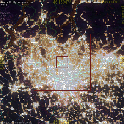
» Earth at Night: Flat Maps 2012, 2016