Cabiate night lights from space
Night Light of Cabiate (Lombardy) from space (Italy) Src. Average luminocity for 10x10km area is 94.1212% and for 50x50km: 72.9293%.
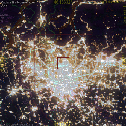
Analysis of Cabiate night lights 2016
Square area 10x10 km:
 59.7%
59.7%90-99
18.64%80-89
6.21%70-79
8.33%60-69
7.12%50-59
0%40-49
0%30-39
0%20-29
0%10-19
0%0-9
0%Square area 50x50 km:
27.29%90-99
18.42%80-89
7.11%70-79
8.65%60-69
8.98%50-59
6.34%40-49
5.24%30-39
5.51%20-29
3.95%10-19
4.97%0-9
3.53%Clear (daylight) street map image can be seen on geolist.org.
Map coordinates:
46° 9' 48" North, 8° 28' 14.2" East
45° 40' 27" North, 9° 10' 25.5" East
45° 10' 50.6" North, 9° 52' 36.7" East
Some cities around Cabiate sort by population:
• Seregno
3.6 km =2.2 mi,  137°
137°
• Giussano
4 km =2.5 mi,  43°
43°
• Seveso
3.9 km =2.4 mi,  218°
218°
• Meda
2.1 km =1.3 mi,  227°
227°
• Mariano Comense
2.6 km =1.6 mi,  14°
14°
• Verano Brianza
4.3 km =2.7 mi,  67°
67°
• Barlassina
4.1 km =2.5 mi,  239°
239°
• Carugo
4.2 km =2.6 mi,  25°
25°
6535748 (p: 7,395)
Sources (retrieved 2019-11-25):
» Earth at Night: Flat Maps 2012, 2016