Isola del Liri night lights from space
Night Light of Isola del Liri (Latium) from space (Italy) Src. Average luminocity for 10x10km area is 51.6769% and for 50x50km: 17.0096%.
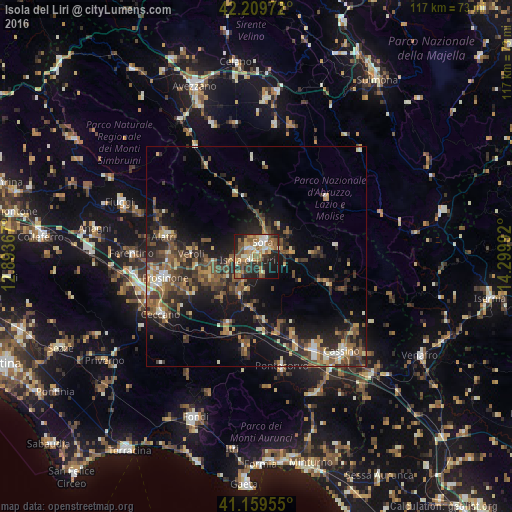
Analysis of Isola del Liri night lights 2016
Square area 10x10 km:
 4.38%
4.38%90-99
9.74%80-89
8.12%70-79
6.82%60-69
12.01%50-59
13.64%40-49
4.38%30-39
7.95%20-29
17.86%10-19
12.99%0-9
2.11%Square area 50x50 km:
0.77%90-99
2.13%80-89
1.59%70-79
2.04%60-69
2.5%50-59
4.42%40-49
3.52%30-39
3.56%20-29
6.68%10-19
12.38%0-9
60.4%Clear (daylight) street map image can be seen on geolist.org.
Map coordinates:
42° 12' 35" North, 12° 53' 37.2" East
41° 41' 12.4" North, 13° 35' 48.4" East
41° 9' 34.4" North, 14° 17' 59.7" East
Some cities around Isola del Liri sort by population:
• Frosinone
21.9 km =13.6 mi,  256°
256°
• Sora
3.8 km =2.4 mi,  21°
21°
• Ceccano
25.6 km =15.9 mi,  240°
240°
• Ferentino
28.3 km =17.6 mi,  270°
270°
• Alatri
21.8 km =13.5 mi,  283°
283°
• Pontecorvo
26 km =16.2 mi,  167°
167°
• Ceprano
17.1 km =10.6 mi,  203°
203°
• Tecchiena
20.9 km =13 mi, 270°
3175427 (p: 10,805)
Sources (retrieved 2019-11-25):
» Earth at Night: Flat Maps 2012, 2016