Isernia night lights from space
Night Light of Isernia (Molise) from space (Italy) Src. Average luminocity for 10x10km area is 22.9481% and for 50x50km: 6.8643%.
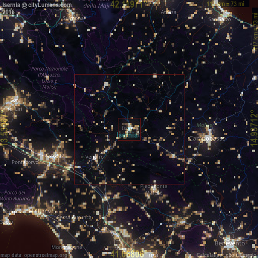
Analysis of Isernia night lights 2016
Square area 10x10 km:
 1.46%
1.46%90-99
3.73%80-89
3.25%70-79
3.41%60-69
2.27%50-59
0.16%40-49
5.52%30-39
6.17%20-29
3.57%10-19
19.64%0-9
50.81%Square area 50x50 km:
0.16%90-99
0.86%80-89
0.87%70-79
0.84%60-69
0.86%50-59
1.09%40-49
1.14%30-39
1.36%20-29
1.25%10-19
2.24%0-9
89.33%Clear (daylight) street map image can be seen on geolist.org.
Map coordinates:
42° 7' 11" North, 13° 31' 51.1" East
41° 35' 45.7" North, 14° 14' 2.4" East
41° 4' 5" North, 14° 56' 13.6" East
Some cities around Isernia sort by population:
• Campobasso
36.3 km =22.6 mi,  96°
96°
• Cassino
35.9 km =22.3 mi,  250°
250°
• Piedimonte Matese
29.5 km =18.3 mi,  157°
157°
• Venafro
20 km =12.4 mi,  230°
230°
• Bojano
23.2 km =14.4 mi,  121°
121°
• Castel di Sangro
23.4 km =14.5 mi,  333°
333°
• Zuni
43 km =26.7 mi,  191°
191°
• Teano
40.8 km =25.4 mi,  200°
200°
3175445 (p: 16,945)
Sources (retrieved 2019-11-25):
» Earth at Night: Flat Maps 2012, 2016