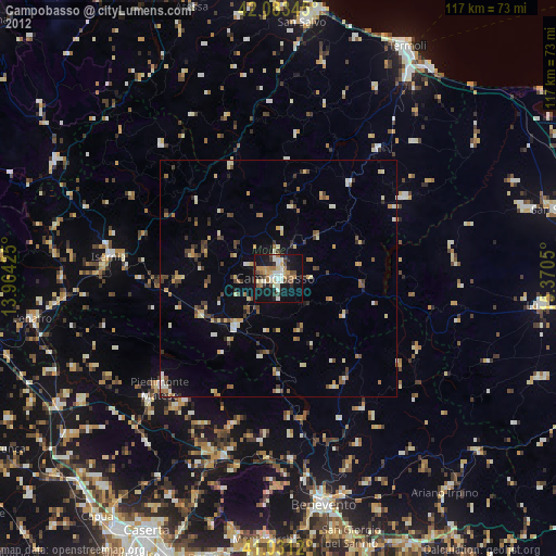
Campobasso night lights from space
Night Light of Campobasso (Molise) from space (Italy) Src. Average luminocity for 10x10km area is 38.898% and for 50x50km: 6.6726%.
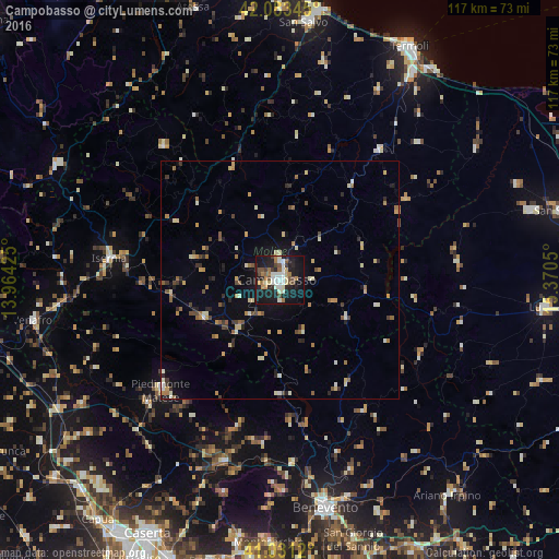
Analysis of Campobasso night lights 2016
Square area 10x10 km:
 6.12%
6.12%90-99
9.52%80-89
2.38%70-79
3.57%60-69
6.63%50-59
3.57%40-49
6.12%30-39
3.23%20-29
11.05%10-19
42.01%0-9
5.78%Square area 50x50 km:
0.37%90-99
1.2%80-89
0.75%70-79
0.92%60-69
0.99%50-59
0.82%40-49
0.86%30-39
0.68%20-29
1.32%10-19
3.58%0-9
88.52%Clear (daylight) street map image can be seen on geolist.org.
Map coordinates:
42° 5' 0.4" North, 13° 57' 51.3" East
41° 33' 34.1" North, 14° 40' 2.5" East
41° 1' 52.3" North, 15° 22' 13.8" East
Some cities around Campobasso sort by population:
• Benevento
48.6 km =30.2 mi,  169°
169°
• Isernia
36.3 km =22.6 mi,  276°
276°
• Piedimonte Matese
34.1 km =21.2 mi,  227°
227°
• Venafro
52.3 km =32.5 mi,  260°
260°
• Bojano
18.3 km =11.4 mi,  243°
243°
• Montenero di Bisaccia
46 km =28.6 mi,  11°
11°
• Larino
34.3 km =21.3 mi,  37°
37°
• Telese
39.8 km =24.7 mi,  197°
197°
3180991 (p: 39,723)
Sources (retrieved 2019-11-25):
» Earth at Night: Flat Maps 2012, 2016