Grottaglie night lights from space
Night Light of Grottaglie (Apulia) from space (Italy) Src. Average luminocity for 10x10km area is 37.7062% and for 50x50km: 24.1964%.
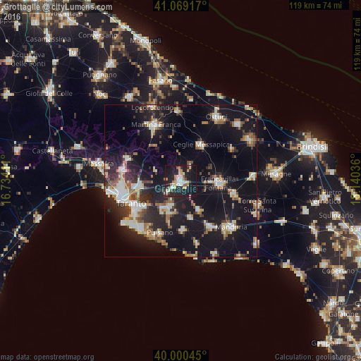
Analysis of Grottaglie night lights 2016
Square area 10x10 km:
 4.06%
4.06%90-99
8.77%80-89
5.36%70-79
4.87%60-69
5.52%50-59
3.08%40-49
2.11%30-39
1.3%20-29
17.53%10-19
43.02%0-9
4.38%Square area 50x50 km:
3.22%90-99
4.09%80-89
2.61%70-79
1.98%60-69
2.91%50-59
2.95%40-49
2.71%30-39
3.48%20-29
7.96%10-19
27.88%0-9
40.21%Clear (daylight) street map image can be seen on geolist.org.
Map coordinates:
41° 4' 9" North, 16° 44' 2.8" East
40° 32' 13" North, 17° 26' 14" East
40° 0' 1.6" North, 18° 8' 25.3" East
Some cities around Grottaglie sort by population:
• Francavilla Fontana
12.5 km =7.8 mi,  92°
92°
• Ceglie Messapica
13.9 km =8.6 mi,  28°
28°
• San Giorgio Ionico
10 km =6.2 mi,  208°
208°
• San Marzano di San Giuseppe
10.7 km =6.6 mi,  148°
148°
• Villa Castelli
6 km =3.7 mi, 31°
• Carosino
8.6 km =5.3 mi,  202°
202°
• Monteiasi
6.2 km =3.9 mi,  228°
228°
• Fragagnano
12.3 km =7.6 mi,  164°
164°
3175773 (p: 31,320)
Sources (retrieved 2019-11-25):
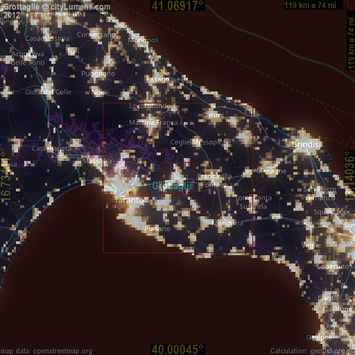
» Earth at Night: Flat Maps 2012, 2016