Perugia night lights from space
Night Light of Perugia (Umbria) from space (Italy) Src. Average luminocity for 10x10km area is 58.0182% and for 50x50km: 12.7991%.
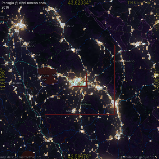
Analysis of Perugia night lights 2016
Square area 10x10 km:
 13.33%
90-99
13.33%80-89
3.48%70-79
6.21%60-69
7.73%50-59
11.97%40-49
12.42%30-39
4.85%20-29
15.91%10-19
10.76%0-9
0%Square area 50x50 km:
1.14%90-99
2%80-89
1.02%70-79
1.55%60-69
1.52%50-59
1.88%40-49
2.62%30-39
1.85%20-29
4.65%10-19
10.1%0-9
71.65%Clear (daylight) street map image can be seen on geolist.org.
Map coordinates:
43° 37' 24" North, 11° 41' 8.4" East
43° 6' 43.9" North, 12° 23' 19.6" East
42° 35' 48.3" North, 13° 5' 30.9" East
Some cities around Perugia sort by population:
• Bastia umbra
13.8 km =8.6 mi,  112°
112°
• Umbertide
21.7 km =13.5 mi,  348°
348°
• Chiugiana-La Commenda
6.7 km =4.2 mi,  256°
256°
• Marsciano
21.5 km =13.4 mi,  188°
188°
• Santa Maria degli Angeli
16.3 km =10.1 mi, 112°
• Magione
14.7 km =9.1 mi,  282°
282°
• Castiglione del Lago
28.4 km =17.6 mi,  272°
272°
• bishopric of Perugia
0 km =0 mi,  26°
26°
3171180 (p: 120,137)
Sources (retrieved 2019-11-25):
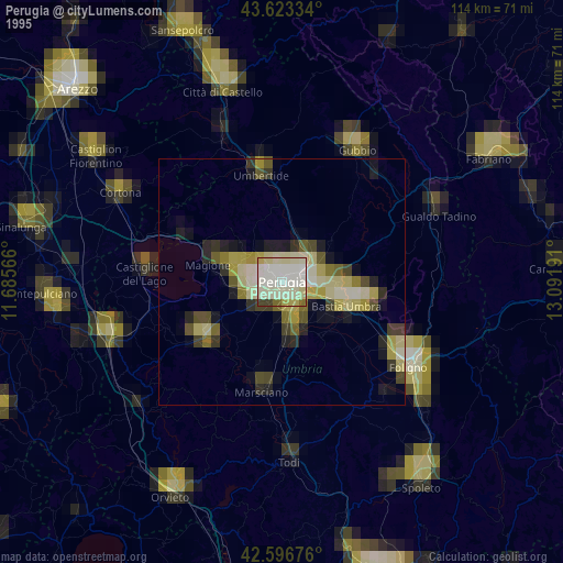
» NASA, Earths city lights 1995
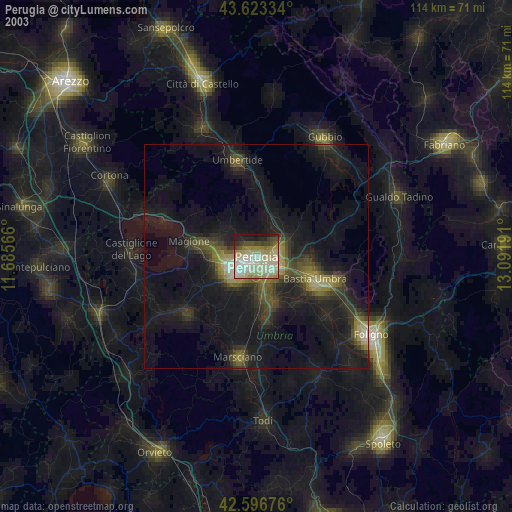
» NASA city lights 2003
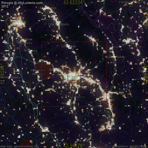
» Earth at Night: Flat Maps 2012, 2016