Cremona night lights from space
Night Light of Cremona (Lombardy) from space (Italy) Src. Average luminocity for 10x10km area is 57.397% and for 50x50km: 21.2733%.
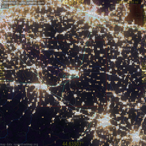
Analysis of Cremona night lights 2016
Square area 10x10 km:
 14.55%
90-99
18.18%80-89
3.94%70-79
2.27%60-69
5.61%50-59
3.94%40-49
6.67%30-39
9.7%20-29
28.79%10-19
6.36%0-9
0%Square area 50x50 km:
2.48%90-99
3.53%80-89
1.73%70-79
1.92%60-69
2.62%50-59
2.26%40-49
2.28%30-39
3%20-29
6.33%10-19
26.05%0-9
47.81%Clear (daylight) street map image can be seen on geolist.org.
Map coordinates:
45° 37' 37.6" North, 9° 19' 5.4" East
45° 7' 59.7" North, 10° 1' 16.6" East
44° 38' 6.3" North, 10° 43' 27.9" East
Some cities around Cremona sort by population:
• Codogno
25.2 km =15.7 mi,  277°
277°
• Fiorenzuola d'Arda
24.7 km =15.3 mi,  200°
200°
• Manerbio
26.2 km =16.3 mi,  20°
20°
• Soresina
21.4 km =13.3 mi,  323°
323°
• Verolanuova
22.2 km =13.8 mi,  11°
11°
• Quinzano d'Oglio
20.2 km =12.6 mi,  357°
357°
• Pontevico
16.5 km =10.3 mi, 19°
• Pontenure
23.5 km =14.6 mi,  230°
230°
3177838 (p: 59,561)
Sources (retrieved 2019-11-25):
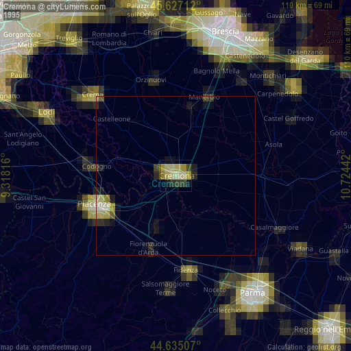
» NASA, Earths city lights 1995
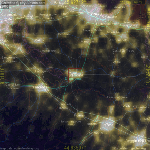
» NASA city lights 2003
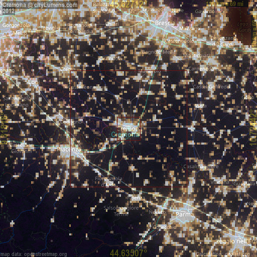
» Earth at Night: Flat Maps 2012, 2016