Carugo night lights from space
Night Light of Carugo (Lombardy) from space (Italy) Src. Average luminocity for 10x10km area is 85.4182% and for 50x50km: 67.1436%.
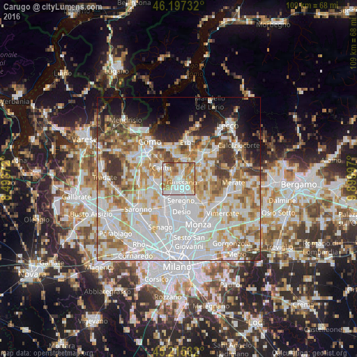
Analysis of Carugo night lights 2016
Square area 10x10 km:
 30.45%
90-99
21.67%80-89
10%70-79
17.88%60-69
13.79%50-59
3.18%40-49
3.03%30-39
0%20-29
0%10-19
0%0-9
0%Square area 50x50 km:
24.54%90-99
16.88%80-89
6.65%70-79
8.27%60-69
8.1%50-59
5.83%40-49
4.57%30-39
5.25%20-29
3.93%10-19
6.27%0-9
9.73%Clear (daylight) street map image can be seen on geolist.org.
Map coordinates:
46° 11' 50.4" North, 8° 29' 37.4" East
45° 42' 30.5" North, 9° 11' 48.6" East
45° 12' 55.2" North, 9° 53' 59.9" East
Some cities around Carugo sort by population:
• Cantù
6.3 km =3.9 mi,  305°
305°
• Giussano
1.3 km =0.8 mi,  135°
135°
• Meda
6.2 km =3.9 mi,  212°
212°
• Mariano Comense
1.8 km =1.1 mi,  221°
221°
• Carate Brianza
4.8 km =3 mi, 139°
• Verano Brianza
3.1 km =1.9 mi, 135°
• Inverigo
3.7 km =2.3 mi,  27°
27°
• Cabiate
4.2 km =2.6 mi, 205°
6535116 (p: 5,466)
Sources (retrieved 2019-11-25):
» Earth at Night: Flat Maps 2012, 2016