Acilia-Castel Fusano-Ostia Antica night lights from space
Night Light of Acilia-Castel Fusano-Ostia Antica (Latium) from space (Italy) Src. Average luminocity for 10x10km area is 83.7646% and for 50x50km: 40.9046%.
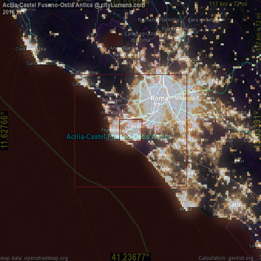
Analysis of Acilia-Castel Fusano-Ostia Antica night lights 2016
Square area 10x10 km:
 31.98%
90-99
28.25%80-89
2.27%70-79
6.98%60-69
13.47%50-59
11.2%40-49
3.08%30-39
1.62%20-29
1.14%10-19
0%0-9
0%Square area 50x50 km:
13.37%90-99
10.58%80-89
3.56%70-79
4.04%60-69
4.17%50-59
4.24%40-49
3.88%30-39
4.04%20-29
5.72%10-19
9.16%0-9
37.26%Clear (daylight) street map image can be seen on geolist.org.
Map coordinates:
42° 17' 8.5" North, 11° 37' 39.6" East
41° 45' 48.1" North, 12° 19' 50.8" East
41° 14' 12.4" North, 13° 2' 2.1" East
Some cities around Acilia-Castel Fusano-Ostia Antica sort by population:
• Lido di Ostia
5.7 km =3.5 mi,  232°
232°
• Fiumicino-Isola Sacra
7.9 km =4.9 mi,  276°
276°
• Casal Palocco
2.1 km =1.3 mi,  140°
140°
• Pomezia
17.6 km =10.9 mi,  126°
126°
• La Massimina-Casal Lumbroso
12.4 km =7.7 mi,  10°
10°
• Selcetta
12 km =7.5 mi,  88°
88°
• Fregene
14.7 km =9.1 mi,  311°
311°
• Vitinia
7.1 km =4.4 mi,  64°
64°
3183539 (p: 129,362)
Sources (retrieved 2019-11-25):
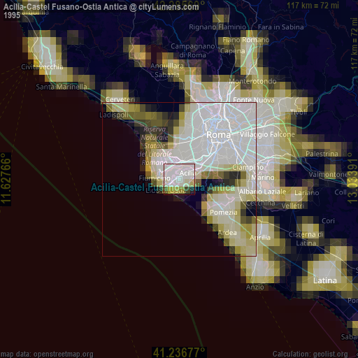
» NASA, Earths city lights 1995
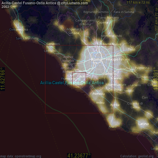
» NASA city lights 2003
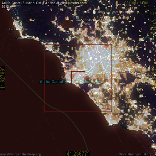
» Earth at Night: Flat Maps 2012, 2016