Semnan night lights from space
Night Light of Semnan from space (Iran) Src. Average luminocity for 10x10km area is 62.9493% and for 50x50km: 7.8082%.

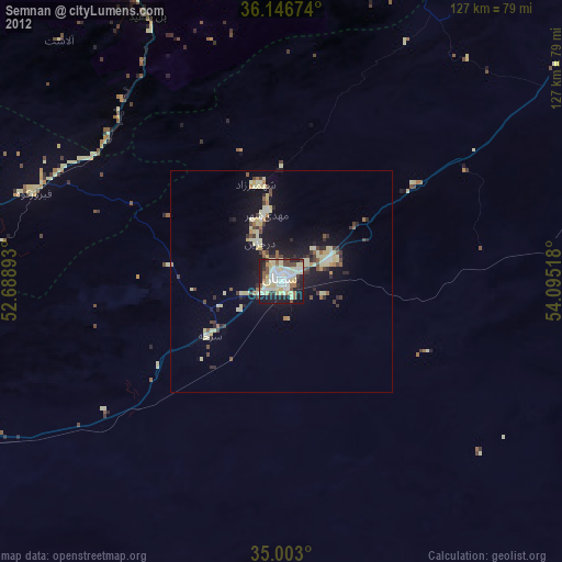
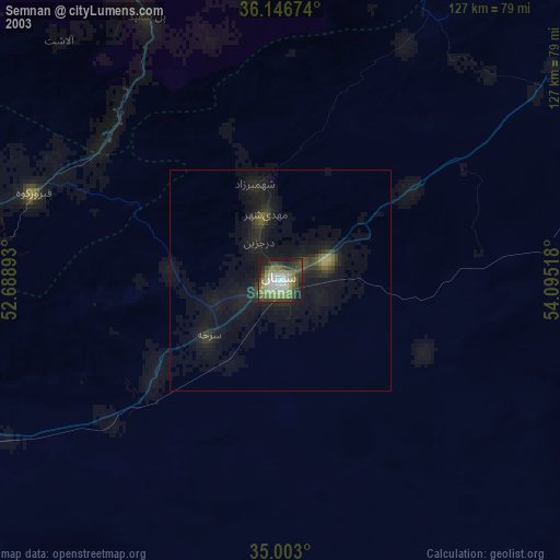
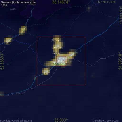
Analysis of Semnan night lights 2016
Square area 10x10 km:
 15.21%
90-99
12.59%80-89
3.85%70-79
17.31%60-69
6.99%50-59
8.04%40-49
4.9%30-39
11.36%20-29
15.03%10-19
4.72%0-9
0%Square area 50x50 km:
0.93%90-99
0.86%80-89
0.32%70-79
2.11%60-69
0.99%50-59
0.76%40-49
0.84%30-39
1.4%20-29
2.16%10-19
7.18%0-9
82.46%Clear (daylight) street map image can be seen on geolist.org.
Map coordinates:
36° 8' 48.3" North, 52° 41' 20.1" East
35° 34' 36.9" North, 53° 23' 31.4" East
35° 0' 10.8" North, 54° 5' 42.6" East
Some cities around Semnan sort by population:
• Sari
113.7 km =70.6 mi,  344°
344°
• Bābol
125.9 km =78.2 mi,  329°
329°
• Behshahr
124.9 km =77.6 mi,  6°
6°
• Dāmghān
108 km =67.1 mi,  52°
52°
• Īstgāh-e Rāh Āhan-e Garmsār
105.2 km =65.4 mi,  248°
248°
• Nekā
119.7 km =74.4 mi,  355°
355°
• Damāvand
120.5 km =74.9 mi,  277°
277°
• Mahdishahr
15.3 km =9.5 mi,  346°
346°
116402 (p: 124,826)
Sources (retrieved 2019-11-25):
» NASA, Earths city lights 1995
» NASA city lights 2003
» Earth at Night: Flat Maps 2012, 2016