Bam night lights from space
Night Light of Bam (Kerman) from space (Iran) Src. Average luminocity for 10x10km area is 72.0972% and for 50x50km: 8.7968%.
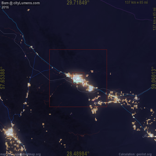
Analysis of Bam night lights 2016
Square area 10x10 km:
 26.59%
90-99
23.61%80-89
4.96%70-79
5.16%60-69
2.98%50-59
5.75%40-49
6.55%30-39
6.94%20-29
15.28%10-19
2.18%0-9
0%Square area 50x50 km:
1.42%90-99
1.7%80-89
0.69%70-79
0.81%60-69
1.31%50-59
0.78%40-49
0.95%30-39
1.3%20-29
2.9%10-19
7.9%0-9
80.23%Clear (daylight) street map image can be seen on geolist.org.
Map coordinates:
29° 43' 6.6" North, 57° 39' 14" East
29° 6' 21.6" North, 58° 21' 25.2" East
28° 29' 23.4" North, 59° 3' 36.5" East
Some cities around Bam sort by population:
• Kerman
179.9 km =111.8 mi,  316°
316°
• Zahedan
246.8 km =153.4 mi,  79°
79°
• Sirjan
262.4 km =163 mi,  278°
278°
• Rafsanjān
270.1 km =167.8 mi,  302°
302°
• Mīnāb
252.4 km =156.8 mi,  209°
209°
• Zarand
256.6 km =159.4 mi, 317°
• Rāvar
282.7 km =175.7 mi,  328°
328°
• Bardsīr
194.9 km =121.1 mi, 297°
141736 (p: 99,268)
Sources (retrieved 2019-11-25):
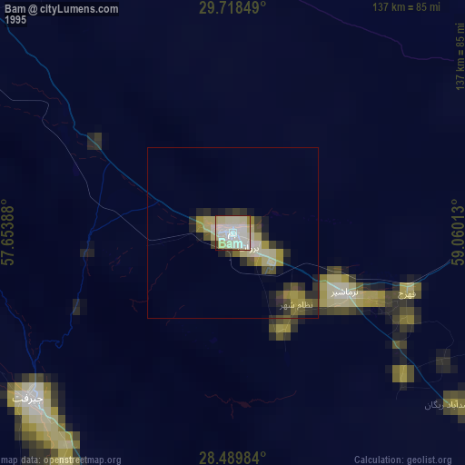
» NASA, Earths city lights 1995
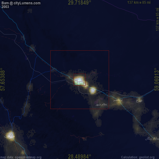
» NASA city lights 2003
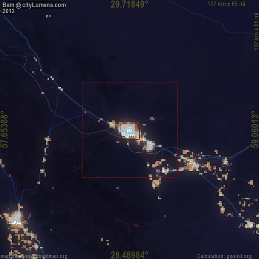
» Earth at Night: Flat Maps 2012, 2016