Kerman night lights from space
Night Light of Kerman from space (Iran) Src. Average luminocity for 10x10km area is 95.0476% and for 50x50km: 19.8882%.
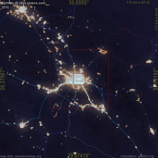
Analysis of Kerman night lights 2016
Square area 10x10 km:
 58.61%
90-99
28.94%80-89
2.38%70-79
1.83%60-69
4.21%50-59
2.56%40-49
1.28%30-39
0.18%20-29
0%10-19
0%0-9
0%Square area 50x50 km:
4.29%90-99
3.46%80-89
1.82%70-79
1.71%60-69
2.66%50-59
2.69%40-49
2.51%30-39
2.83%20-29
4.93%10-19
12.24%0-9
60.86%Clear (daylight) street map image can be seen on geolist.org.
Map coordinates:
30° 53' 18.6" North, 56° 22' 32.4" East
30° 16' 59.6" North, 57° 4' 43.6" East
29° 40' 27" North, 57° 46' 54.9" East
Some cities around Kerman sort by population:
• Sirjan
163.5 km =101.6 mi,  235°
235°
• Rafsanjān
105 km =65.2 mi,  277°
277°
• Bam
179.9 km =111.8 mi,  136°
136°
• Zarand
76.8 km =47.7 mi,  320°
320°
• Shahr-e Bābak
189.3 km =117.6 mi,  264°
264°
• Rāvar
112.3 km =69.8 mi,  346°
346°
• Bardsīr
62.9 km =39.1 mi,  230°
230°
• Shahrak-e Pābedānā
114.9 km =71.4 mi,  325°
325°
128234 (p: 577,514)
Sources (retrieved 2019-11-25):
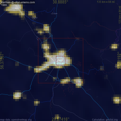
» NASA, Earths city lights 1995
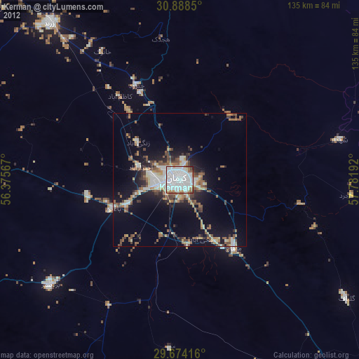
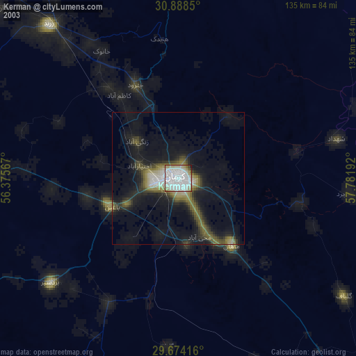
» NASA city lights 2003
» Earth at Night: Flat Maps 2012, 2016