Alīgūdarz night lights from space
Night Light of Alīgūdarz (Lorestān) from space (Iran) Src. Average luminocity for 10x10km area is 31.2203% and for 50x50km: 3.832%.
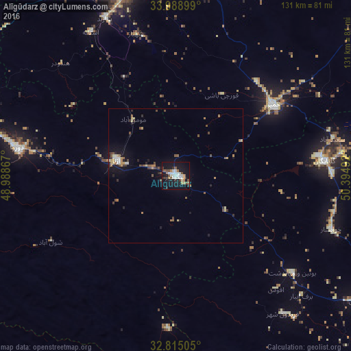
Analysis of Alīgūdarz night lights 2016
Square area 10x10 km:
 6.29%
6.29%90-99
6.47%80-89
1.92%70-79
0.87%60-69
4.9%50-59
2.97%40-49
5.24%30-39
2.45%20-29
4.02%10-19
44.41%0-9
20.45%Square area 50x50 km:
0.44%90-99
0.46%80-89
0.42%70-79
0.35%60-69
0.56%50-59
0.65%40-49
0.74%30-39
0.4%20-29
0.72%10-19
3.21%0-9
92.07%Clear (daylight) street map image can be seen on geolist.org.
Map coordinates:
33° 59' 20.4" North, 48° 59' 19.2" East
33° 24' 14.4" North, 49° 41' 30.4" East
32° 48' 54.2" North, 50° 23' 41.7" East
Some cities around Alīgūdarz sort by population:
• Arāk
76.8 km =47.7 mi,  0°
0°
• Borūjerd
102.9 km =63.9 mi,  302°
302°
• Khomeyn
44.5 km =27.7 mi,  54°
54°
• Aznā
74.2 km =46.1 mi,  287°
287°
• Golpāyegān
55.6 km =34.5 mi,  84°
84°
• Delījān
112.6 km =70 mi, 54°
• Khvānsār
61.4 km =38.2 mi,  109°
109°
• Fareydūnshahr
65.2 km =40.5 mi,  142°
142°
143921 (p: 91,041)
Sources (retrieved 2019-11-25):
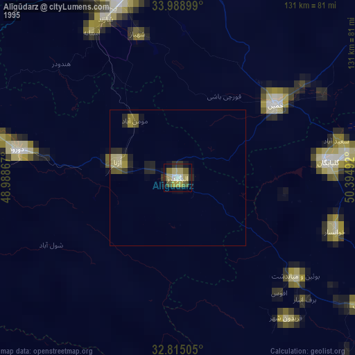
» NASA, Earths city lights 1995
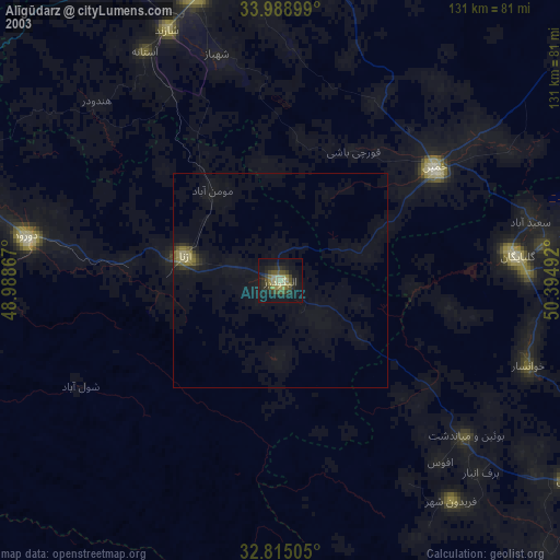
» NASA city lights 2003
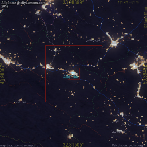
» Earth at Night: Flat Maps 2012, 2016