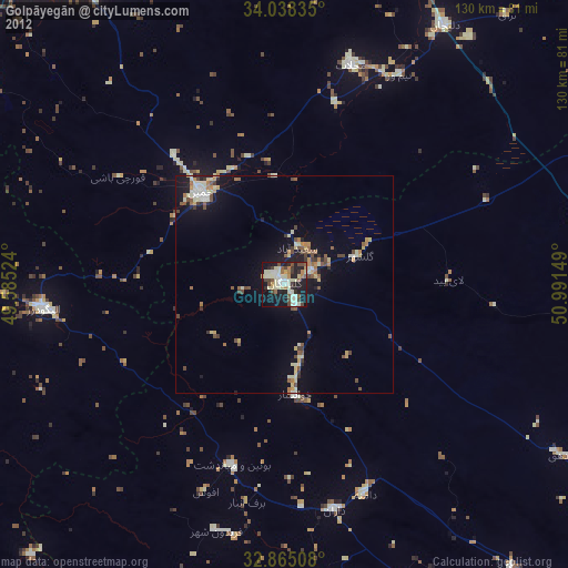
Golpāyegān night lights from space
Night Light of Golpāyegān (Isfahan) from space (Iran) Src. Average luminocity for 10x10km area is 49.3654% and for 50x50km: 8.0743%.
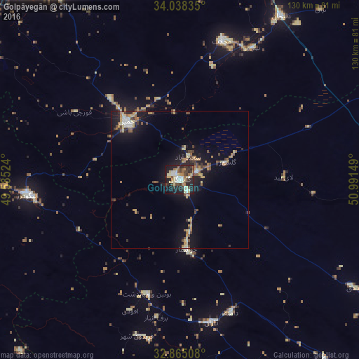
Analysis of Golpāyegān night lights 2016
Square area 10x10 km:
 6.12%
6.12%90-99
9.27%80-89
12.59%70-79
4.55%60-69
6.47%50-59
3.5%40-49
6.64%30-39
10.31%20-29
19.23%10-19
19.23%0-9
2.1%Square area 50x50 km:
0.53%90-99
0.84%80-89
1.67%70-79
1.02%60-69
1.2%50-59
0.98%40-49
1.32%30-39
1.08%20-29
1.99%10-19
7.04%0-9
82.31%Clear (daylight) street map image can be seen on geolist.org.
Map coordinates:
34° 2' 18.1" North, 49° 35' 6.9" East
33° 27' 13.3" North, 50° 17' 18.1" East
32° 51' 54.3" North, 50° 59' 29.4" East
Some cities around Golpāyegān sort by population:
• Arāk
89.8 km =55.8 mi,  322°
322°
• Alīgūdarz
55.6 km =34.5 mi,  264°
264°
• Khomeyn
28.2 km =17.5 mi, 316°
• Aznā
127 km =78.9 mi,  277°
277°
• Delījān
70 km =43.5 mi,  31°
31°
• Fārsān
135.5 km =84.2 mi,  169°
169°
• Khvānsār
26 km =16.2 mi, 174°
• Fareydūnshahr
59.1 km =36.7 mi,  195°
195°
133037 (p: 44,916)
Sources (retrieved 2019-11-25):
» Earth at Night: Flat Maps 2012, 2016