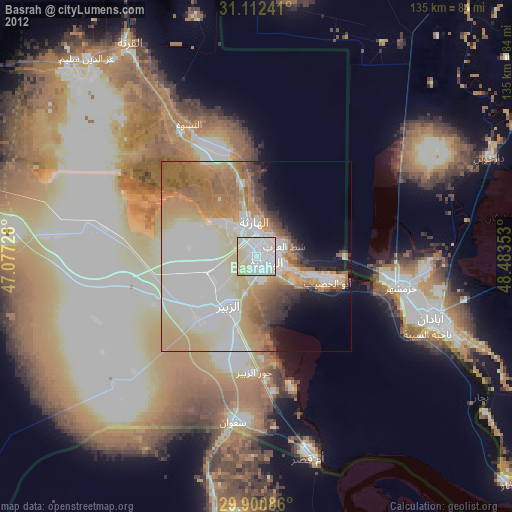
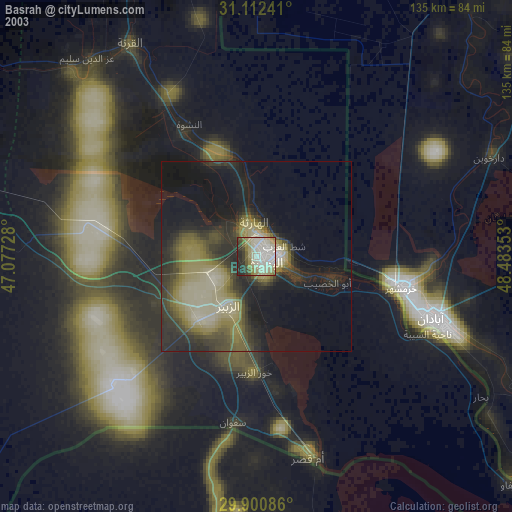
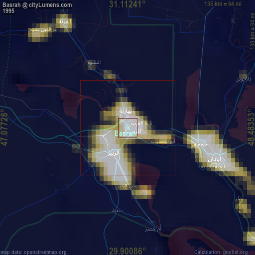
Basrah night lights from space
Night Light of Basrah (Basra) from space (Iraq) Src. Average luminocity for 10x10km area is 98.6154% and for 50x50km: 59.3209%.
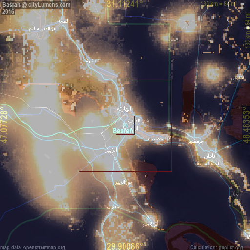
Analysis of Basrah night lights 2016
Square area 10x10 km:
 70.88%
90-99
23.08%80-89
6.04%70-79
0%60-69
0%50-59
0%40-49
0%30-39
0%20-29
0%10-19
0%0-9
0%Square area 50x50 km:
18.73%90-99
13.57%80-89
8.71%70-79
8%60-69
9.92%50-59
5.1%40-49
4.44%30-39
3.88%20-29
3.35%10-19
3.79%0-9
20.5%Clear (daylight) street map image can be seen on geolist.org.
Map coordinates:
31° 6' 44.7" North, 47° 4' 38.2" East
30° 30' 30.7" North, 47° 46' 49.4" East
29° 54' 3.1" North, 48° 29' 0.7" East
Some cities around Basrah sort by population:
• Al Başrah al Qadīmah
3.4 km =2.1 mi,  100°
100°
• Abadan, IR
53.6 km =33.3 mi,  110°
110°
• Khorramshahr, IR
39.4 km =24.5 mi, 101°
• Az Zubayr
15 km =9.3 mi,  210°
210°
• Umm Qaşr
54.2 km =33.7 mi,  165°
165°
• Al Fāw
89.2 km =55.4 mi,  131°
131°
• Al Hārithah
8.7 km =5.4 mi,  347°
347°
• Shādegān, IR
86.1 km =53.5 mi,  79°
79°
99532 (p: 2,600,000)
Sources (retrieved 2019-11-25):
» NASA, Earths city lights 1995
» NASA city lights 2003
» Earth at Night: Flat Maps 2012, 2016