Ujjain night lights from space
Night Light of Ujjain (Madhya Pradesh) from space (India) Src. Average luminocity for 10x10km area is 91.0833% and for 50x50km: 21.478%.
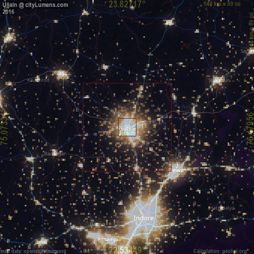
Analysis of Ujjain night lights 2016
Square area 10x10 km:
 39.96%
90-99
30.68%80-89
9.09%70-79
8.14%60-69
8.9%50-59
3.22%40-49
0%30-39
0%20-29
0%10-19
0%0-9
0%Square area 50x50 km:
2.03%90-99
2.87%80-89
1.83%70-79
1.84%60-69
3.24%50-59
4.12%40-49
5.28%30-39
5.63%20-29
7.04%10-19
12.88%0-9
53.23%Clear (daylight) street map image can be seen on geolist.org.
Map coordinates:
23° 49' 37.8" North, 75° 4' 23.9" East
23° 10' 56.6" North, 75° 46' 35.1" East
22° 32' 4.2" North, 76° 28' 46.4" East
Some cities around Ujjain sort by population:
• Dewas
37.3 km =23.2 mi,  130°
130°
• Tarāna
32 km =19.9 mi,  58°
58°
• Maksi
38.7 km =24 mi,  77°
77°
• Unhel
28.1 km =17.5 mi,  307°
307°
• Gautampura
34.1 km =21.2 mi,  230°
230°
• Sānwer
23.7 km =14.7 mi,  167°
167°
• Hātod
43.4 km =27 mi,  185°
185°
• Piploda
39.7 km =24.7 mi,  298°
298°
1253914 (p: 457,346)
Sources (retrieved 2019-11-25):
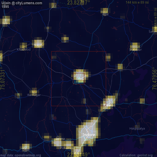
» NASA, Earths city lights 1995
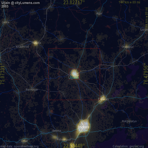
» NASA city lights 2003
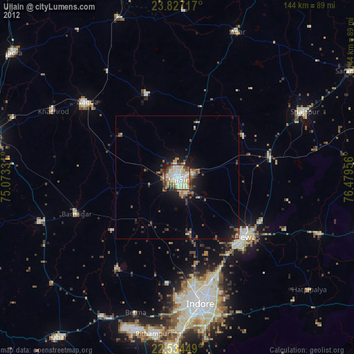
» Earth at Night: Flat Maps 2012, 2016